Yakushima: Gear List and Gear Reviews

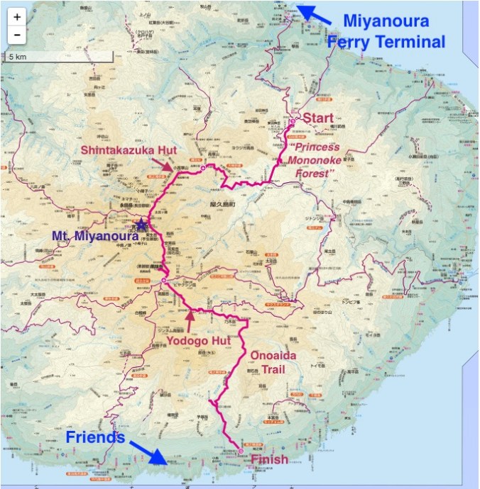
What hiking blog would be complete without a post about gear? On my Yakushima trip, I finally got to test out my “big three” pieces of gear that I collected in anticipation of my JMT hike.

(Disclaimer: I’m testing out some Amazon affiliate links in this post. So, yeah, I’m really cool and you want to be just like me. So buy all the same things I have so I can make money and never have to go back to a desk job.)

Big Three

IMG_1061

I believe this is the most popular pack for PCT and AT thru-hikers. I met a guy at the hostel in Kagoshima who had hiked the AT and who was carrying the same pack. It comes in purple, so I was sold. I have long torso, so I ordered regular length with a small waistbelt. When I carried it back from the US it hurt my back weird and I was worried I got the wrong size. However, I moved the waist belt up as high as it will go and now it fits fine. When I put everything in the pack, it was heavy to lift, but once on my back it didn’t feel heavy. I guess that’s what you want in a pack right?

I did lose my 1L Nalgene bottle from one of the side pockets in northern Kyushu (probably from putting it on a luggage rack on the train), but aside from that functionality seems good.

IMG_1210

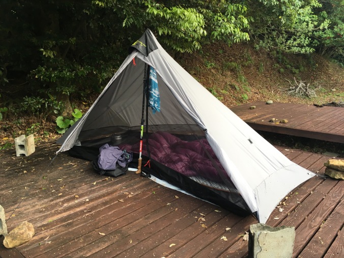
This tent appealed to me because it has no tent poles and can just be squished into its stuff sack, or anywhere. Also it is very roomy for a one-person ultra-light tent (no leaving pack outside under vestibule) and at $180 + $30 for seam sealing, it was cheap compared to other tents I was considering.

Some online reviews mention condensation issues, but I did not experience any, despite the rainy and humid conditions on Yakushima (but it wasn’t cold anywhere I used it). Other reviews mention a learning curve for pitching the tent right. The tent sets up with a trekking pole and minimum of 6 stakes. I got an extra stake and guyline to create more headroom and stability in the wind. I practiced setting the tent up once in Yoyogi Park before I left for my trip. Then I had a crash course in setting it up in a thunderstorm when I got to Yakushima and then a crash course setting it up in the rain with no stakes using rocks and concrete blocks when I arrived at South Village. At South Village, the next morning I did some adjustments to pitch the tent a bit higher to make the floor float properly and get more air flow, but I never got wet and the tent didn’t collapse overnight when I just hastily pitched it in the rain. The silnylon is a bit stretchy and billows in the wind but it’s quiet (doesn’t make any slappy noises), and since I put in an extra stake for headroom, the billowing didn’t bother me at all and I slept great. I was a bit worried about it not being freestanding, but now I’m not. This is a very comfy tent for people like me who like having good ventilation. May not be as good for people seeking warmth from their shelter (but not sure any tent provides that). Due to the shape, even though this tent has almost as much floor space as many 2-person ultralight tents, most of that floor space does not have headroom, so it really is only a 1-person tent, just with tons of room to spread out your gear.

If I buy a two-person tent in the near future (so Kiwi sig other can join me on some adventures), I’m considering the Tarptent Double Rainbow just because I like the name. I aspire to reach this level of stoke in the outdoors!

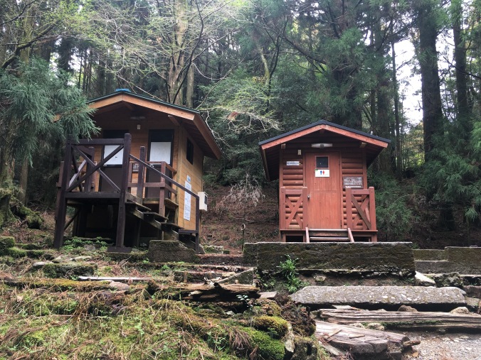
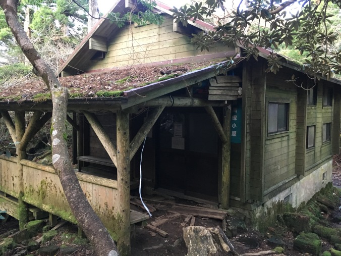
Perhaps my greatest enjoyment in life is sleeping, and this quilt is so light and warms up so fast it’s like sleeping in a cloud. I used this as my primary comforter all winter in Nozawa, when I figured I’d practice living without heat. After the first night in Shintakazuka Hut, I woke up and put on my still damp hiking clothes from the day before. I didn’t feel particularly cold even though I could see my breath in the darkness of the hut. Later in the day chatting with other hikers who had stayed at Shintakazuka, they complained it had been cold at night and that they had to get up and put on more layers. I wore a normal cotton T-shirt and some Uniqlo Heattech Extra Warm tights as PJs. I was never cold, so I guess my quilt worked great! I’m going to get a thermometer so that in the future I actually know how cold it was to gauge whether this sleeping bag is sufficient for the Sierras in early October.

The quilt was great for a place with climate as varied as Yakushima. Camping at subtropical sea level, I could unzip it flat and just put a corner over my belly. Here’s a great video about why quilts are better than sleeping bags:

For this trip I used the quilt with a cheap imitation Thermarest Z lite foam sleeping pad I got off Amazon.

All my campsites were flat with no pokey things, and I was pretty comfy. With my superpowers of being able to sleep anywhere, I can even side sleep on a cheap foam pad. Listening to people blow up air pads and have to faff with deflating them in the morning at the huts makes me think I will just stick with a foam pad. It was also super convenient to just throw down and mark my spot on the ferry.

IMG_1234

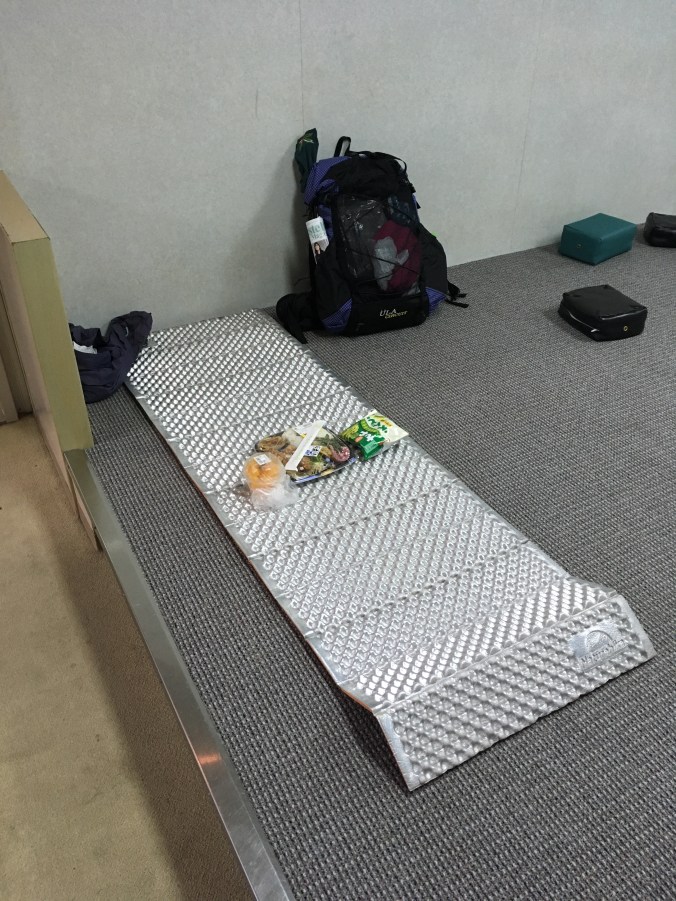
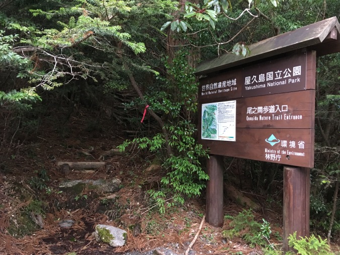
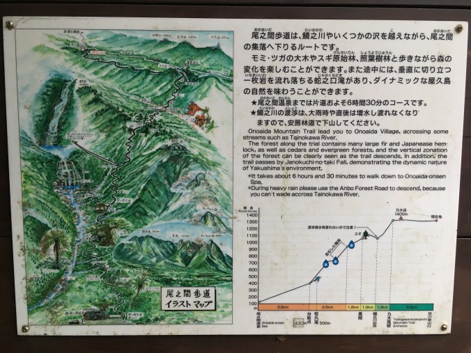
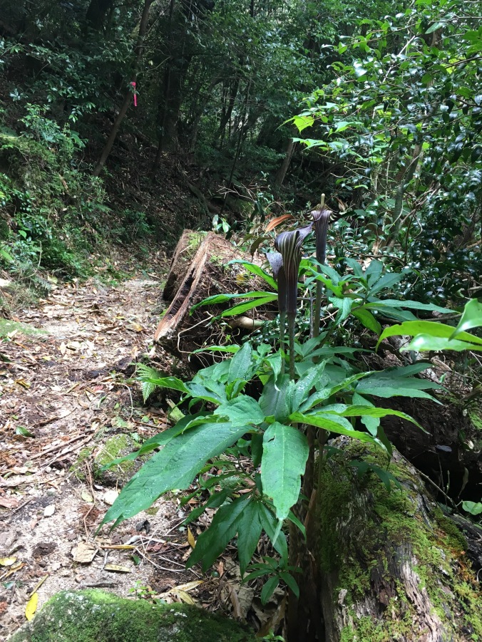
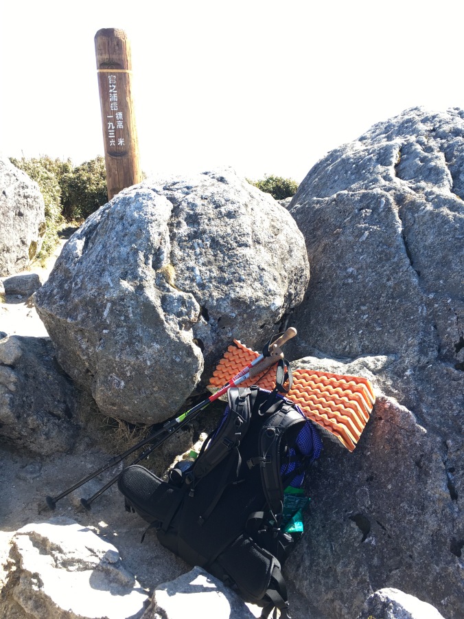
The only annoying thing is having a bulky thing strapped to the outside of your pack when the trail is super narrow and overgrown and you have to climb under trees or out of holes like on the Onoaida Trail, and I’m thinking of chopping it down a little so it packs better.

Footwear

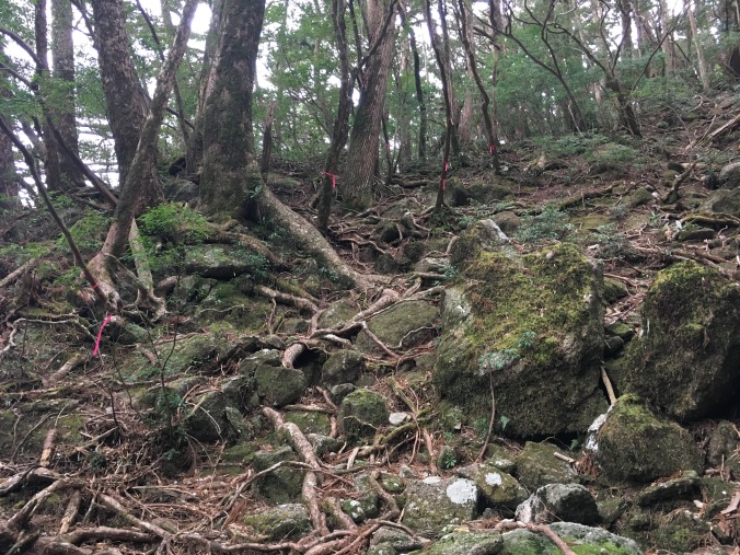
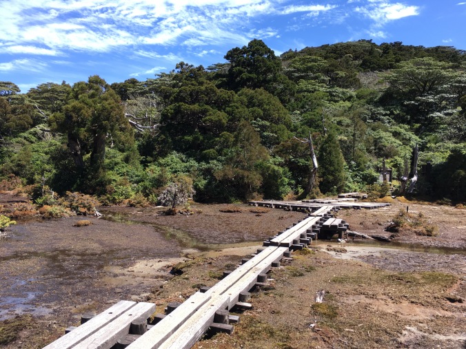
I hiked in my Brooks Cascadia trail runners, partly as an experiment and partly because I was travelling to Yakushima following a yakimono tour in northern Kyushu and clomping around in hiking boots would’ve been annoying for the other part of my trip. The good thing about hiking in trail runners was that Yakushima is really wet. Because most of the island is a giant piece of granite with a thin covering of soil, wherever there is trail, there is likely water running down it. The hiking your shoes dry thing advocated by Andrew Skurka really works. When I pulled into camp early the second day, I put my shoes in a patch of afternoon sun and they were completely dry in less than an hour. On the other hand, on the third day, going down the treacherous Onoaida Trail, my ankles really suffered from lack of support.

Kitchen

I bought a super cheap tiny canister stoveand aluminum cook set from Amazon to try out.

IMG_1009
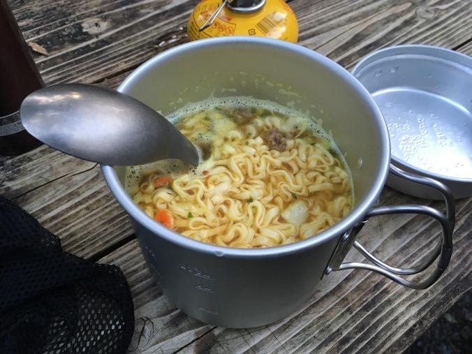
The tiny no brand Made in China stove worked great. I came up with a routine to boil 600ml of water at dinner and breakfast. I would pour 300ml into my little Thermos for a hot drink (coffee in the morning, herbal tea at night – actually one night I made umeshu oyuwari from some homemade umeshu generously offered to me by another hiker) and then use the remaining 300 ml for the hot part of my meal (instant ramen at dinner, two packs of instant miso soup for breakfast). So I’m now considering upgrading to this 700ml titanium cook pot.

Clothing

I brought way more clothing than necessary, but I used everything.

My basic hiking outfit was:

  • Long-sleeve Kathmandu merino wool hiking shirt (purchased in NZ)
  • Uniqlo Heattech leggings
  • Synthetic capri sweatpants I bought for bouldering
  • Darn Tough hiking socks (I wore through my two beloved pairs of Smartwool hiking socks over the winter so I replaced them with two pairs of Darn Tough socks to see which brand is more durable.)
  • A Gap sports bra and some synthetic sport underwear from Target

For outer layers I had:

  • Mountain Hardware fleece – This thing is pretty heavy, but very warm. Kiwi sig other purchased it for me secondhand from a gear exchange shop in Colorado Springs. I could’ve brought my Uniqlo ultralight down parka instead, which would have been lighter and less bulky for similar warmth, but I considered that Yakushima is really wet. I rolled this up at night and used it as a pillow, and for that use I was grateful for its bulk.
  • North Face lightweight rain jacket – Debated bringing this or a real Goretex hardshell. But lightness and packability won out. I was blessed with amazing weather so didn’t end up regretting my decision.
  • Uniqlo ultralight down vest – Extra puffy layer just for camp.

PJs/camp clothes:

  • Extra pair Darn Tough socks
  • Uniqlo Heattech Extra Warm leggings
  • Tokyo Snow Club T-shirt – represent!

On the first day of hiking, going upward in elevation, I was really sweaty when I showed up at camp and couldn’t wait to get into dry camp clothes. (In the morning, putting on cold, damp hiking clothes was fine; they warmed up and dried right away when I started hiking.) The second day, hiking at high elevation, I didn’t get sweaty and probably would’ve been fine sleeping in my hiking clothes. But all in all, I think I’m going to be a hiker that carries PJs. The sleep comfort is worth it!

Other weather protection:

  • Baseball cap – frontwards for sun, backwards when no sun (totally hit my head on a tree branch that was obstructed from my view by the brim)
  • Merino wool Buff – I like to wear this as a light beanie; it was needed for covering ears when hiking above tree line where it was really windy
  • Snowboarding glove liners – Gloves were needed above tree line. These cheap Mizuno “breath thermo” ones  really do stay warm when wet. However, they totally get destroyed by velcro on my snowboard jacket, snowboard boots, etc. Not a problem for hiking, fortunately. (I also have a breath thermo balaclava which I really like because it is really thin and doesn’t get too wet and gross when you breath through it.)
  • Sunglasses
  • Tenugui – bandanna/sweat towel

Onsen kit: (That’s right! A third set of clothes! Totally not ultralight hiking! Brought this stuff in anticipation of having two chill days at the hostel.)

  • Extra underwear and sports bra
  • Extra short sleeve synthetic t-shirt (I actually had two extra t-shirts so that in case I ended up hiking in a short sleeve shirt I’d still have a clean shirt at the end.)
  • Extra tenugui to use as towel
  • 2 sets single use packets of shampoo and conditioner
  • Shea body butter

Other

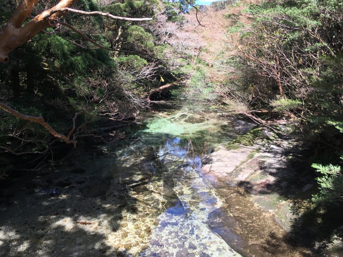
Water system – Sawyer Squeeze Water Filter and one of the 32oz bags that came with it. I used a 1L PET bottle as “clean” drinking water bottle but cooked with unfiltered water out of the Sawyer Squeeze bag. With this set up, I could carry 2L of water, which I never did except at camp. I carried about 500ml when I was hiking, but frankly, you don’t have to carry ANY water on Yakushima. It’s flowing out of everywhere. And no one was filtering the water either. I just filtered to practice using my filter. (Monkeys and yakushika were hanging around near the huts and I’m sure pee and poo in the water sources so…)

Trekking poles – I would have died on Onoaida Trail without trekking poles. I have PaceMaker Stix Expedition Trekking Poles. Not the lightest or most compact, but they have flip locks and cork grips and cost less than 50 bucks.

Toiletries:

  • Tsubaki (camellia) oil doubles as face oil and hair product – Luxury item! (I use this face oil made by the agriculture union on Toshima, one of the Izu islands that looks like a little cupcake floating in the sea. Why pay LVMH for a brand name when you can get it straight from the producer way cheaper. It also makes cool Tokyo omiyage since it’s technically a product of Tokyo.)
  • Toothbrush and toothpaste
  • chapstick, sunblock
  • Potty kit – Hand sanitizer and 2 packets of pocket tissue (also had to use pocket tissue to wipe down cook pot, as you’re not allowed to wash your dishes on the trail)
  • Glasses, contact case, contact solution – I want to get Lasik.

Other camp goods:

  • headlamp
  • eye mask and ear plugs – Used ear plugs to block out thunderstorm the first night, probably don’t need eye mask on the trail since everyone sleeps when it gets dark and wakes up before light but may need it for travelling (hostel/ferry) so will probably still carry it.
  • first aid kit (advil and antihistamine, electrolyte tab, bandaids, blister patch, ankle brace)
  • Swiss army knife – not used, but good idea to have right?
  • journal, map and pen
  • nylon eco-bag – I used this to carry stuff around camp. I want to replace it with a tiny, ultralight backpack like this one so that I can use it to carry water and some essentials when I drop my heavy pack to go off on a side trail.
  • Some extra ziplock bags and trashbags to keep things dry in case it rained

I feel like gear wise I was very prepared. The first night I pulled out my headlamp and it wouldn’t turn on, but I was prepared with spare batteries. After this hike, the only things I would add to my kit are a thermometer, a proper orienteering compass (I have a crappy one stuck on my key chain), and a small packable backpack. As a final note, on the way back to Tokyo, Jetstar let me check my pack in (on a domestic Japanese flight) with my sleeping pad and trekking poles just strapped to the outside. (I left my fuel can and lighter at the hostel along with my unused wag bags for the next hiker.)

Yakushima: Choose-your-own-adventure-land

So, you’ve read about my Yakushima adventure and want to plan your own. This post provides information about my trip that may be relevant to your trip planning.

Yakushima Hike Map

My Yakushima adventure

My Yakushima trip was very spur of the moment. I had already purchased a plane ticket to Fukuoka for a Kyushu ceramics tour and then decided to attach Yakushima to my Kyushu trip. This was literally the first time I just went traveling without knowing where I was going to sleep every night.

I used as reference http://www.yakumonkey.com/ and http://www.yakushimalife.com/. But once I was on the road I didn’t have reliable Internet, so I bought the Yama to Kougen Yakushima hiking map (山と高原 is the series of maps used by most Japanese hikers) when I got to Kagoshima and it became the primary resource I really used to plan my trip. The map comes with a little handy guide with trail descriptions and model routes for day hikes and multi-day traverses. It also has campsite and hut information and phone numbers for emergency, lodging, transportation, etc. It is completely in Japanese.

Why I like to call Yakushima “Choose-your-own-adventure-land” is it is a really easy place to go with no plans. According to the Internets, the campsites are rarely crowded and no reservations are required (or taken) for the mountain huts. (Of course, I would avoid Golden Week or any Japanese public holidays.) There are six mountain huts. Two are located close to a trailhead and four are centrally located high up in the mountains around Mt. Miyanoura. The two located near the trailheads — Shiratani Hut and Yodogo Hut — make it possible to catch a ferry from Kagoshima in the morning, take a bus to a trailhead in the afternoon and stay at a hut the night you arrive. (I didn’t need to bring a tent, I just wanted to test out the one I bought for the JMT.) All trails are connected and lead to Mt. Miyanoura, and the centrally located alpine huts mean there are plenty of places to retreat in case of bad weather.

Itinerary

My plan when I arrived on the island was:

Day 1: Get oriented. Camp in Miyanoura.

Day 2-4: Hike for three days staying 2 nights in mountain huts.

Day 5-6: Chill at South Village youth hostel with friends.

Curio beach rest day

Kurio Beach rest day

Food

I purchased ~3500-4000 yen worth of food for my 3-day hike from a grocery store in Kagoshima, consisting of instant ramen, instant miso soup, tea, instant coffee, nuts and chocolate, bread, tuna, granola biscuits and cheese. I would recommend purchasing food on the mainland because there is more selection and it is cheaper. However, there is a relatively large supermarket at a shopping center very close to the Miyanoura tourist info center.

After the hike I spent maybe 4500 yen on food in 2 days while staying at South Village. We bought stuff from a grocery store in Kurio and went out to a nice izakaya for Brig’s b-day.

Transportation

I had to take the jetfoil to the island because the normal ferry was under maintenance when I departed. The jetfoil cost 8400 yen and takes about 2 hours. Website here.

On the way back I enjoyed riding on the normal ferry — Ferry Yakushima 2. It costs 4500 yen and takes about 4 hours. It’s a nice ferry with a gift shop, cafe, various seating areas, and library, which I appreciated because I didn’t bring any reading materials. I borrowed a book and learned about the geology on Yakushima. I also struck up a conversation with a 70-year-old hiker (we identified each other by our backpacks) from Fukuoka who has been to Yakushima over 60 times and plans to make it to 70 trips by the end of the year. He gave me a lot of great tips for my next trip to Yakushima. There was also an amazing view of Kaimondake, Kyushu’s little Mt. Fuji, from the ferry.

There is also a municipally run overnight ferry that is 3000-some yen. My friends took it and said it was okay. It’s the cargo ferry and docks overnight at Tanegashima. The issue with the overnight ferry is that it doesn’t leave from the main ferry terminal in Kagoshima and it’s a bit of a mission to get to the right ferry terminal.

Jetstar flights between Kagoshima and Narita can be had from about 6500 yen each way.

On the island I relied on the bus. There is a bus that goes pretty regularly on the main road most of the way around the island, maybe once an hour. For hikers, there are four buses a day to Shirataniunsuikyo from Miyanoura, and two buses a day to Yakusugiland from Anbo (the other main town on the island). For an idea of bus fares, here’s what I actually spent:

Bus from Miyanoura to Shirataniunsuikyo – 520 yen

Bus from Hirauchi to Kurio beach – 500-some yen each way

Bus from Hirauchi to Miyanoura Port – 1870 yen

Lodging

The first night I ended up illegal camping (oops) at Oceanview Campsite. There isn’t much in the way of facilities there, but it was free.

The 2nd and 3rd nights I stayed in the mountain huts. These are free, but I paid the recommended donation of 2000 yen for overnight campers in the national park.

After my hike, I spent two nights tent camping at South Village youth hostel. It was 1080 yen per night for “camping” with access to a well-appointed guest house with kitchen, dining and lounging areas, big screen TV, washers/dryers, bathrooms, showers and private hinokiburo! The staff were really nice and I definitely want to stay there again. (Actually, I would love to work there…) The website says they only take reservations for 3-nights or longer, but you can stay there for a shorter period of time depending on availability.

For Kagoshima lodging I stayed at Green Guesthouse Kagoshima. A capsule is 2300 yen/night (single sex dorm was full when I went). It is just okay. The building shakes when large trucks go by. Reception wouldn’t accept my takkyubin in typical inflexible Japanese service manner. (I get that they are small and don’t want everyone to send their luggage ahead, but I sent my sleeping pad and trekking poles to arrive the day I checked in and after I checked in they still wouldn’t just receive the package for me. I had to wait for redelivery in person.) Wifi was spotty. But it’s less than 5 min from the ferry terminal, so would probably stay there again if going back to Yakushima on a solo trip.

Moneys

In summary, for 6 days, 5 nights on the island, I spent around 20,000 yen not including the cost of getting to and from the island. Including cost of getting to and from the island from Kagoshima, staying a night in Kagoshima (which you have to do because of ferry times unless you take the overnight ferry) and the cost of flights to and from Tokyo, I spent about 50,000 yen on my trip to Yakushima.

Yakushima Hike Day 3: Off the Beaten Path

When everyone’s packing up and leaving Yodogo Hut in the morning I catch dad from Morioka and inform him that, after sleeping on it, I have decided to take Onoaida Trail (尾之間歩道) and end my 3-day journey at Onoaida Onsen (尾之間温泉). I thank him for the confidence boost. If he thinks I can make it to Tachudake and back down to the 3-something PM bus out of Yakusugi Land, I should be able to make it down Onoaida Trail to the south of the island in good time. It’s going to be all downhill, right? I loved feeling like I was the only person on the trail yesterday so I’d like to go off the beaten path, I say. Before I really looked at any maps, my initial idea had been to hike north to south since my friends are staying at South Village, and I think there will be a sense of completion to say I hiked north to south across the island to meet them. He thinks its a fine idea and since we have both been hiking faster than the standard estimated course times thinks I’ll make it to Onoaida Onsen in 5 hours, which means I could probably finish before it starts to rain. We bid each other farewell and good luck.

IMG_1126

Yodogo at dawn

I arrive at Yodogo trailhead in less than an hour, use the toilet and ask the ranger about the weather. He asks me where I am going. I say, Onoaida Onsen, I hope to make it there before it starts to rain. The trail is long but you should not miss Janokuchi Falls (蛇之口滝) on the way down, he advises.

IMG_1129.jpg

Yodogo Trailhead

IMG_1130

Onoaida Trailhead

I study the trail description. 8.5 km down to the junction with Janokuchi Waterfall and then 3.5 km to Onoaida Onsen. “It takes about 6 hours and 30 minutes to walk down to Onoaida-onsen Spa.” Easy-peasy.

IMG_1131

Description at Onoaida Trailhead

“Onoaida” means “between the ridges”. The little trail guide that came with my map, says Onoaida Trail is impassable if the water level at Tainokawa crossing (鯛之川出合) is high, there are numerous stream crossings and the trail may not be well-marked, GPS is advised. It has not rained in the past two days, so I figure I’ll be fine. As I hoped, the trail does not look well travelled, but I identify a set of fresh boot prints, and it is reassuring to know that at least one other person thinks the trail is passable today.

According to the hiking etiquette book I received at Shirataniunsuikyo (白谷雲水峡)trailhead, if you use trekking poles, you are supposed to put rubber caps on the tips of your poles to protect the environment. I didn’t bring rubber tips with me and though 90% of the other people were using rubber tips, no one had called me out so far, not even any of the licensed guides. I figured that staying safe and not spraining an ankle was more important than following the rules, so I used my poles with their normal carbide tips anyway, but I did try to keep my poles on the trail, on wooden boardwalk or gravely or hard rock surfaces and away from any tree roots or moss covered surfaces. This was no longer possible as the trail seemed to consist entirely of tree roots or moss covered surfaces.

IMG_1142

It’s a few minutes past 7AM when I start down Onoaida Trail. By 8:30 AM, I reach what must be the lookout point to Nogidake (乃木岳). According to the map at the top of the trail, that places me about 3 km in and more than a quarter of the way down the trail. I’m making good time.

IMG_1148

Nogidake?

So far Onoaida Trail is like a better version of Shirataniunsuikyo, with a lot of interesting mosses and fungi and other plant life.

About 9:15 AM I’m at the first stream crossing, I assume it’s Tainokawa and that I’ve made it another kilometer as I climb up the other side.

Then it’s an endless repetition of climbing down to a small stream, rock hopping across it and climbing up the other side. Except the streams get bigger and bigger as I head down.

The trail is well-marked with pink tape, though sometimes I reach one piece of tape and must spin around, tiptoe or duck down to find the next piece of pink tape. A few hours in I find myself turning a corner peering around for the next pink tape, locating it and exclaiming, “You’ve got to be kidding me!”

A sign along the trail explains that Onoaida Trail is an old logging route from the Edo Period (circa 1600), when yakusugi roof shingles were contributed by the locals to the lords of Satsuma Domain and up to first Toyotomi Hideyoshi and later the Tokugawa Shogunate. Since yakusugi are so large, they were cut into shingles at the site where the tree was felled and bundles of shingles were carried out of the mountains by people on foot. “Think of the labor of the men who laid out the stones of the trail,” exhorts the sign. A large part of the trail is a jumble of moss-covered stones. The trail description calls these “moss covered stone steps” which sounds very romantic and benign, but in reality, they do not resemble steps at all, they are slippery and there is no where to put your foot flat. In sections, it is obvious the trail has washed out leaving a red mud pit to climb around, or if that is not possible, down into and out the other side. I also climb over or under felled trees (at one point I almost have to take off my pack to get through). I slip and fall and scrape up my palm, bang up my shins, twist each ankle more than a few times and will later develop a giant bruise on my hip. (Later I learn that since it was a high snow year, the trail is probably in especially bad condition.)

It’s 1PM, I have been telling myself that I will break for lunch at the resting pavilion by the fork to Janokuchi falls but it is nowhere in sight. I’m starting to get worried. I’ve stopped observing the plant life along the trail and stopped taking photos.

I’ve already been hiking for seven hours, six on this god-forsaken horrible not-trail.

There’s a rustling in the brush and four young guys, probably in their early 20s and judging from their accents probably English, appear about 10 feet down the steep trail from me. The forest is so dense you can only see that far ahead.

“How much farther to the waterfall?” I ask hopefully.

“About one-and-a-half hours,” is the reply.

I can live with that. They say they are headed to Yodogo Hut for the night. I tell them I came from there and it’s beautiful. “This is a hard trail isn’t it? Does it get easier past the waterfall?”

“Not really,” says one of them and they proceed to tell me about how the trail is collapsed, they had to climb around it in part. Something inside me collapses in disappointment. I’d been hoping that at least the section of trail from Onoaida Onsen up to the waterfall would be better maintained since that should be the route for a day hike.

“It’s the same up ahead,” I say. “And there are a lot of stream crossings. You guys are the only people I’ve seen on this trail all day and I started at 7 am.”

“That sounds awesome!” one of them says and they plow on.

After they pass, I feel reassured that I am getting close to the waterfall and going to make it out of the woods before dark. Then, I start to feel bad that I didn’t emphasize more that its taken me over 7 hours to get here. Even if I am slow, I am going downhill. It’s going to be hard for them to make it to Yodogo Hut by nightfall; it’s already 1 PM, and it gets dark by 7 PM. Then, I rationalize: there are four of them, they looked like they had the right gear and they are young; they’ll survive.

Finally at 3:15 PM, I reach the pavilion at Janokuchi fork. I drop my pack and trekking poles under the pavilion, drink the rest of my water, stuff some granola cookie things in my face and take a break by running (okay walk briskly) to Janokuchi Falls. Without the weight of my pack, scrambling and hopping is a lot easier.

IMG_1185

A welcome sign of civilization!


I’m at the falls by 3:45, spend a few minutes snapping pictures and head quickly back.

I’m still hoping to get a quick onsen before I have to catch the bus. I’m already going to miss the 3-something bus I initially intended to catch, but there’s another one at 5-something.

I’ve started talking to myself. I’m praying to the weather gods out loud: “Thanks for all the awesome weather this trip so far. Thank you for holding off the rain. Please keep holding off the rain.” I’m cheering myself on: “Go team! Good job, Ankles. That’s it, Knees. Just hang in there for another hour. We’ve all been together 35 years and no one has failed us yet. Guess what? We are pretty bad ass! I promise to take good care of you. (When this is over.) We’re going to the onsen!”

The four guys were wrong. The trail following the fork to the waterfall is much easier. Wider and obviously much more travelled. Once you descend a certain elevation the trail becomes loamy and soft, as there is actual soil (including 1 meter of volcanic ash from a nearby explosion 6300 years ago) around the perimeter of Yakushima. The vegetation becomes subtropical and there are palm trees and interesting tropical looking flowers.

IMG_1182

At 5:30 PM, I emerge from the bush into the parking lot of Onoaida Onsen. Finish! I sit on a bench in front of the building for a minute and check my bus schedule while the stray cats fed by the guy at the front desk mill around. Great! If I’m in and out in 20 minutes I can totally make the bus.

IMG_1209

Onoaida Onsen

Onoaida Onsen is written up as “very hot, I don’t know how locals manage to get in” even on Japanese review sites because the spring water comes out of the ground at 49 degrees (Celsius) and the bath is about 46 degees. Whatever, I spent the entire winter bathing almost exclusively in the soto-yu at Nozawa Onsen (average temp around 45) and now think normal onsen temp of 40-42 degrees is nurui (not hot enough). The atmosphere is also a bit similar to the soto-yu at Nozawa Onsen. You have to bring your own soap and towels and while there are a couple shower nozzles, they are exclusively for hair washing. I wash myself like the locals using the bucket method with the hot water directly from the tub in the manner I picked-up in Nozawa. Onoaida Onsen is very barebones but the current wooden building is relatively nice and new and I liked it a lot.

As I’m leaving the onsen, it finally starts to rain. Finally, my rain jacket comes in handy. It’s a 20-minute walk down the road to the main road that circles the island. I make it to the main road just as a bus is about to pass. I flag the bus down, but it’s not the right bus! Turns out I read my bus schedule wrong and missed the bus I wanted to catch. It’s about 6:15 and the next bus going as far as Hirauchi (平内) isn’t for another hour. It starts to rain harder and I retreat to an abandoned vegetable stand alongside the road for shelter to consider my options. I guess I can wait for an hour as it grow dark, or… I can hitchhike?

I’ve never done this before, but I stick out my thumb and the third car picks me up. My driver is a super cool single-mom artist who lives in Hirauchi and makes hand-dyed and hand-sewn clothes. She says she’s originally from Shizuoka but drove down and across Japan looking for a new place to live and when she got to Yakushima, she knew this was the place for her. She drops me off at the hostel and gives me her number to keep in touch.

I check in to South Village and contemplate staying in a bunk instead of setting up my tent in the rain, but a bunk is three times more expensive than a campsite and campers get access to all the same common facilities. I’ve also hauled my tent for three days all the way across the middle of the island. The campsite is composed of raised wooden platforms, so I give myself a crash course in setting up my tent with concrete blocks and rocks instead of stakes. I manage to do okay. My friends Tina and Brig left me a nice note in front of their tent that they went to Hirauchi Kaichu Onsen. I go to the guesthouse to use the hair dryer, do a load of laundry, and forage for some food. Brig and Tina get back, we all eat dinner together and then watch Kiki’s Delivery Service on the big screen TV in the guesthouse. We turn on the heater. It’s basically glamping. We retreat to our tents at about 11 pm and I look forward to not hiking anymore tomorrow.

Date: April 20 • Start: Yodogo Hut • End: Onoaida Onsen • Distance hiked: 13.2 km
Achievements Unlocked: survived Onoaida Trail • survived not showering for four whole days • hitchhiked for the first time ever!

Bonus: Here’s a map showing the hike I completed. (Kiwi sig other thinks this makes my story make more sense.) Trip data and gear reviews to follow.

Yakushima Hike Map

Yakushima Hike Day 2: So Stoke!

Shin-Takazuka Hut (新高塚小屋) is warm, comfy and quiet until 3:45 AM with the first rustlings of someone getting up to go to the toilet. The wind picked up overnight so I’m grateful for the hut. Since I fell asleep around 8 PM, I’ve just been lying awake in my comfy down cocoon since 3:30 AM after eight and a half hours of solid sleep. I’m enjoying my sleep-in but by 4:45 it’s full-blown crinkling of food wrappers and deflating sleeping pads and the jet sounds of canister stoves. I was going to wait for light to get up and make breakfast outside but at 5 AM I give up and fire up my stove in the light of my headlamp, contributing to not putting enough hot water in my thermos for coffee, which I will only find out later in the day (and top up with cold water).

Today’s big decision is whether to aim for Yodogo Hut (淀川小屋) or Ishizuka Hut (石塚小屋) depending on the weather forecast for Thursday. I’m thinking of staying at Ishizuka Hut and exiting out of Yakusugi Land via Hananoego Trail if the weather for Thursday looks like it will permit a full day hike. Alternately, from Yodogo Hut, it’s only an hour to Yodogo trailhead and then 30 minutes further to a bus stop out of the mountains if Thursday’s weather looks unpleasant. I hope to pick up cell signal to check on the weather from the top of Miyanouradake (宮之浦岳).

As for today, it’s bright blue skies! Departing Shin-Takazuka Hut around 6:15 AM, the hike is up and up and the trees get shorter and more twisted until you pop out around a corner to an amazing view and almost get whipped off the trail by the wind. I try to hold steady to snap a few photos and then am grateful to duck back into the safety of a grove of trees.

IMG_1023

Yakushima’s Half Dome?


IMG_1027

Trees eventually give way to short bamboo grass (which my mom says is like the high mountains in Taiwan – I will have to go see!) and bare granite boulders piled in interesting formations. Yakushima is basically a giant granite plug formed by magma pushing up above sea level. As you hike you can see how the granite is eroding; there are lots of little square pieces of white rock along the trail and you can see them in the granite boulders you walk past. A lot of the trail is raised on wooden boardwalk and stairs because where you put your feet the thin delicate soil will wear off and become a granite path water flows down. You walk through a lot of water, but it’s clear and not muddy because there isn’t enough dirt.

IMG_1040

Looking back at the trail from where I came

IMG_1037

apparently these are potassium feldspar crystals

Three, maybe four, people left the hut in the same direction as me and I pass one and then wave to another a bit of a ways ahead of me, but otherwise I see no one else on the trail. The view is exhilarating and the rock formations fascinating and before I know it I’ve reached the top of Miyanouradake.

IMG_1058

Miyanouradake: Kyushu’s highest peak at 1936 meters (6352 feet)

It’s 9 AM, so I’ve been hiking for almost 3 hours but it totally doesn’t feel that long even though it was uphill because it was so fun and my stoke level is super high. I have the peak all to myself. Not only do I have a 360 degree view to the sea on all sides, I can see the hazy line that is Tanegashima (種子島) on one side and a small more triangular shape of Kuchinoerabujima (口永良部島) on the other. I have a snack, some coffee, text Kiwi sig other that I am still alive and check the weather as cell reception comes in and out. Apparently, it’s supposed to start raining Thursday around noon, but the rain doesn’t look too bad, it’s not thunderstorms like on Monday. If it’s the last day of hiking, even if I get wet and cold I can warm up and clean up at an onsen at the end of the day. Hrm, still not sure where I’ll sleep tonight.

Then another hiker reaches the summit so I decide to head down to give him his own exhilarating top of the world moment. Going down from the summit the trail starts to get more and more wet and marshy, and I begin to see more people. Basic trail etiquette is that people climbing up have the right of way. As I step aside, I feel irrationally resentful of the people carrying daypacks to summit Mt. Miyanoura from Yodogo Trailhead since I somehow feel like I earned it more than them. I start to run into some mountain guides labeled by the ID tags hanging from plastic sleeves around their necks carrying very large packs and their group members carrying much smaller ones. I run into one such guide, smile, say “konnichiwa” and pull aside. He says, there are 30 people in our group, please go ahead where you can. I dodge through the crowd on the trail as if it’s Shinjuku Station. I think I whack a couple with my sleeping pad. WTF. Who hikes in a 30-person group? That would be my absolute nightmare.

IMG_1062

View coming down off Miyaouradake. Note the famous Tofu-iwa (Tofu rock) on the right midground. I think it looks like a sliced mantou (饅頭 – Chinese plain white steamed bun).

Around noon, I drop my pack for the side trail to Kuromidake (黒味岳), where I again find solitude and enjoy having the summit all to myself. Coming down from Kuromidake, I run into 3 other folks. One is a gentleman from Morioka who stayed at Shin-Takazuka Hut the night before and we have a short chat about our plans for the day. (We had chatted about Morioka and Iwatesan yesterday because I’m also familiar with the area because I pass through quite a bit going back to my JET Program hometown in Akita.) I tell him about my dilemma about Ishizuka Hut versus Yodogo Hut and how checking the weather on Miyanouradake didn’t help me reach a conclusion.

IMG_1091

Panorama from the top of Kuromidake

I’m taking a break on a wooden platform at Hananoego (花之江河) junction when I see the guy from Morioka again. This is the junction where I can go to either Ishizuka Hut or Yodogo Hut. “I haven’t decided yet,” I say. He says after he saw me he had a chat with a nice young man who is a grad student in Kagoshima and that guy said he climbed Tachudake yesterday and it should not be missed. So his new plan is to stay at Yodogo Hut, hike the forest road to Yakusugi Land and climb Tachudake (太忠岳) tomorrow. Interesting, I say, that is a full day hiking option out of Yodogo Hut I hadn’t thought of. If he doesn’t mind me possibly glomming onto his plan, I guess I will stay at Yodogo Hut.

A third hiker we know from Shin-Takazuka Hut emerges from the bush. “Where did you come from,” says my new dad from Morioka (turns out he has three daughters in their 30s), “I thought you left earlier than we did.” The third hiker says he’d been hanging out by some rock formations all day. He asks, “Did you see that group of 30 go by?” I say, “Yes. Ugh. Hiking in a group of 30 would be my absolute nightmare!” He tells us, “I overheard they will be staying at Shin-Takazuka Hut tonight. Weren’t we lucky!”

It’s about 1:30 PM when the other hiker and I push on as dad from Morioka lays down for a nap. Photos don’t do Hananoego justice, it looks like a landscaped Japanese garden with ponds enclosed by moss carpeted marsh, framed by wind scarred and shaped white yakusugi, surrounded by mountains dotted with ornamental granite boulders.

IMG_1108

Hananoego, Japan’s southernmost alpine marsh

At 3:10 PM, I arrive at Yodogo Hut. Yodogo (I was corrected by another hiker who said in Yakushima dialect the word for river is pronounced “go”) is really pretty in the afternoon light. It’s shallow, clear as glass and tinted green from the foilage above it. I again claim a spot on the second floor of the hut, then steal a pair of slippers from the hut shoe cubby to use as camp shoes while I stick my socks and shoes in a patch of sun to dry. They are soaked from walking in water half the day. I’m snacking on Yodogo bridge, studying my map with my feet dangling over the water when another hiker points out two yakushima monkeys (smaller than normal Japanese macaques) grooming each other on a tree branch overhanging the river.

IMG_1124

Over dinner, I listen in on the conversation between dad from Morioka and the other hiker from Shin-Takazuka Hut while sipping umeshu no oyuwari (hot plum wine), courtesy of my new dad from Morioka. Turns out they are both serious Hyakumeisan peak baggers pretty close to finishing. Dad from Morioka drove to Kagoshima all the way from Morioka. Yakushima is part of his trip to bag all the Hyakumeisan peaks in Kyushu, with the exception of Mt. Aso, the peak of which is still off-limits due to recent volcanic activity. The other hiker is now pretty much only missing Hokkaido. He tells a story of one time he went on a three day hike and got back to his car at the trailhead only to find he was trapped for three additional days because the forest road back to civilization had washed out. They exchange tips on how to modify your car for better shachuhaku (車中泊 — sleeping in your car) at the trailhead.

At 7 PM it’s hiker lights out. I haven’t seen any manmade structures all day except for trail, and even if there are the huts, there is no electricity. I wonder if I can see any stars. The thought seizes me. I crawl out of my sleeping bag and down the ladder, tiptoe past the other sleeping hikers and run out to Yodogo bridge. But with tomorrow’s cloud cover already coming in, I only see about the same number of stars I usually see in Tokyo.

Date: April 19 • Start: Shin-Takazuka Hut • End: Yodogo Hut • Distance hiked: 9.6 km Achievements Unlocked: first time multi-day hiking • bagged a Hyakumeisan

Yakushima Hike Day 1: Mountain Hut Debut

I’m up at 5:30 AM. Tent is still standing and all pegs are still in the ground. Not really wanting to risk the campsite toilet, I break camp and go to the parking area toilet to wash up. I head back toward town to the bus stop for an 8:15 bus to Shirataniunsuikyo, which is supposed to be the inspiration for the forest in Princess Mononoke. I hope to pick up breakfast on the way to the bus stop to replace the one I ate for dinner the night before, but everything is still closed. The supermarket doesn’t open until 9 AM and the Tourist Info Center and cafe is closed on Tuesdays (good thing it was open yesterday!). Finally, at 8 AM a tourist trap omiyage shop opens and I am able to purchase some bread and Jagariko for breakfast.

The bus gets me to the trail head at Shirataniunsuikyo just before 9 AM. I dutifully use the toilet (toilet opportunities are limited in the mountains on Yakushima and peeing and pooing in the bush is discouraged because of the fragile ecosystem — you are supposed to do all emergency business in wag bags), turn in my “tozan todoke” hiking registration, and pay the recommended 2000 yen donation to the park service for overnight park users.

The “Mononoke Princess forest” is full of the little kodama forest sprites you see in the movie.

kodama

Nah, it’s full of tourists stopping in the middle of the trail to take photos and messing with your hiking pace.

At 10:30 I reach the turn off for the side trail to Taiko-iwa. Another hiker has dropped his pack at the bottom of the trail so I put mine right next to his and start climbing up to Taiko-iwa carrying only my phone to take photos with. Taiko-iwa is an amazing lookout onto a river and river valley painted all shades of spring green and dotted with pink mountain sakura.

IMG_0905

View from Taiko-iwa. Sorry the photo does not do justice to the view, the lighting started to get better later in the day.

By 11:30 I reach the Kusugawa Junction with the Arakawa Trail, which is the most popular trail to Jomon-sugi, the oldest and largest known Yakusugi cedar. Arakawa Trail is an old logging railroad track which makes for super easy walking, so instead of breaking for lunch I just snack as I cruise along.

IMG_0918.jpg

railroad track trail

IMG_0923.jpg

nice composting bio-toilet

IMG_0951

little shrine and spring inside the Wilson Stump

Past the Wilson Stump (a bit of interesting history about Wilson Stump here) the trail gets a bit harder and looks less travelled. I start to wonder if I’m going the right way because isn’t Jomon-sugi the most famous attraction on Yakushima? Then the trail starts to open up with some wooden platform resting areas and then north and south viewing platforms surrounding the famous Jomon-sugi. Later I would meet a 70-year-old man who would wax poetic about when you could walk right up and hug the Jomon-sugi.

IMG_0956.jpg

unnamed yakusugi

IMG_0964.jpg

Jomon-sugi

I didn’t know how fast I would hike so I didn’t know if I would stay at Takazuka Hut just past Jomon-sugi or make it to Shin-Takazuka Hut. It’s only about 3 PM when I arrive at Takazuka Hut so I decide to press on for another hour to Shin-Takazuka Hut.

When I arrive at Shin-Takazuka Hut, there are two Yakushika deer hanging out in front by the sign for the toilet. I quietly slide open the door and poke my head inside. “There are two yakushika right outside the hut!” I whisper expectantly to a group of four older gentlemen heating up their dinner by the entrance. “We’ve seen countless yakushika today” one of them says and turns back to their dinner. No one is impressed and no one exits the hut to take a look.

IMG_1008

yakushika hanging out by toilet sign (photo taken from my second floor window in the hut)

IMG_1014

Shin-Takazuka Hut

It’s only 4 PM but everyone has already unfurled their bedrolls to claim a spot and has a Jetboils fired up to prepare dinner. Shin-Takazuka Hut has an occupancy of 60 people, but that would be in a survival situation with people packed in like sardines, each sleeping pad lined up right up against the next. I’m either the last or the second to last person to show up for the night. The second floor on one side of the hut is completely unoccupied so I climb up the ladder and unpack. I manage to change into a dry T-shirt and clean leggings under my sleeping bag. There are some ropes and hooks strung up inside the hut so I hang my sweaty hiking things up to dry. I had read that you have to hang your food inside the huts or it will get eaten by the cute little yakunezumi rats. I’m pretty sure the rat situation is not helped by everyone cooking in the hut. There is an exclamation downstairs (“Wow, that must be heavy!”) as someone whips out a real frying pan and starts to stir-fry something that smells mighty tasty.

The clouds had been clearing over the course of the day and it’s nice out so I set up my cooking station outside. One of the four older gentlemen that had been cooking near the entrance stops by on his way back from the toilet and asks when I came from today and where I plan to hike to tomorrow. Typical hiker conversation. After a few sentences exchanged he says, “You aren’t Japanese are you? That makes sense. A young Japanese woman wouldn’t go on a solo hike and stay at a mountain hut alone. Do you know Japanese ‘yama gal’? The ones with all the jangling bits hanging off of them.” *motions with hands* (The Japanese was 「チャラチャラしている」) “You can’t tell if they really like mountains or if they are just hiking to look cute.” Another old man in the group pipes up, “I don’t mind the yama gal. They add color to the mountains.” First guy continues, “You, you don’t look out of place at all. “ (「違和感ない。」) Thanks?

Turns out the four are all 70-years-old and part of a hiking group out of Tokyo. They have come from the opposite direction as me and summited Miyanouradake that day. I ask them to invite me along on some future hikes and we exchange contact info.

IMG_1009

dinner!

There is one other solo woman hiker staying in the hut but besides me, everyone seems to be of retirement age. After dinner, it’s not even dark yet but everyone zips into their sleeping bags, so I do the same. Hiker lights out is 7 PM and I think I manage to fall asleep by 8 PM.

Date: April 18 • Start: Shirataniunsuikyo • End: Shin-Takazuka Hut • Distance hiked: 10.7km
Achievements Unlocked: first time solo-hiking • first time cooking on a canister stove • first time staying in a mountain hut

Yakushima Hike Day 0: Getting There

[First in a series of posts about my adventure in Yakushima. It’s come to the point where I think if I wait until I finish writing up everything to upload anything, it’ll never happen.]

I arrive at the jet boat terminal just before 7 AM to try to catch the 7:45 AM jetfoil to Yakushima. By the time I reach the ticket window, the 7:45 is sold out so I get a ticket for the one at 12 noon.

Good thing the hostel I stayed at is less than 5 minutes away from the ferry terminal and I don’t have to check out until noon. I walk back to the hostel, pull my sheets out of the sheet disposal bin, climb back into my capsule and nap for 3 hours.

I arrive at Miyanoura port around 2 PM and make my way to the Visitor’s Center. The Visitor’s Center has free wifi and I sit at a table to pour over my map and newly procured bus schedule. Wifi at the hostel in Kagoshima had been iffy and I hadn’t been able to find an up to date bus schedule online in advance. I meet a couple carrying hiking gear and they ask me where I plan to hike, I say I plan to start at Shirataniunsuikyo and head around to Jomon-sugi and then Mt. Miyanoura. They say they plan to do about the same. I ask if they are starting their hike tomorrow morning. They say, no, they are starting now. They leave to catch the 3:30 PM bus to Shirataniunsuikyo.

IMG_0887

last minute trip planning

I briefly contemplate joining them. But heck, I brought my tent and in Kagoshima I only picked up hiking food for 3 days. I decide to go set up my tent and then come back to town in search of hot dinner.

IMG_0890

Miyanoura town

Google Map is not helpful in finding the municipal run Ocean View Campsite. I walk around in a big circle and finally see a small and faded sign for the turn off to the campsite by a seaside rest area toilet. At the entrance to the campsite is a sign that says “No unauthorized camping. Please register at the tourist information center.” Well, it took me 40 minutes to find this place and I’m not walking back to the tourist info center now as it starts to rain. I circle around the campsite. There is no one there. There is a toilet and some sinks with taps and running water, an old house probably for the overseer and some beehives.

I find a spot sheltered from the wind coming off the sea behind some bushes that looks nice and flat. The rain starts to pick up, so I throw down my sleeping mat and empty out the contents of my pack on to it. My tent is packed at the very bottom of my pack as suggested by some backpack packing diagram on the interwebs. Very smart and practical. (Will def need to rethink this.)

Good thing I practiced setting up my tent in Yoyogi Park once before this trip. I hastily stake my tent down, lever it up with a hiking pole and throw all my stuff inside as it really starts to thunder storm. Now what? I am regretting not having brought my Kindle. It’s about 5 PM.

After a while, I Google how to set up a tarp guyline and teach myself the bowline knot and tautline hitch. Then I throw on my rain jacket and set up a an additional tie out on one side of my tent to give me a bit more headroom in the stormy conditions. I tension up my tent a bit but give up on the prospect of going to town for dinner. I cannibalize a breakfast and turn in for bed around 8 PM.

The rain hitting my tent sounds like a million crinkling potato chip bags. Around midnight, the rain lets up a bit and the wind picks instead. The silnylon of my tent billows so much that I think my extra guyline must’ve given out, but it’s not slapping my face or anything so I’m too lazy to fix it. Sometime in the night, car headlights beam through the bushes and a group of car campers bustles around briefly, setting up camp in the rain. I don’t see think they see me, and by the time I wake up the next morning, they are gone.

Date: April 17 • Start: Kagoshima • End: Miyanoura • Distance hiked: 0 km
Achievements Unlocked: first time stealth camping • successfully pitching tent in the rain • learned to tie some knots