Shin-Takazuka Hut (新高塚小屋) is warm, comfy and quiet until 3:45 AM with the first rustlings of someone getting up to go to the toilet. The wind picked up overnight so I’m grateful for the hut. Since I fell asleep around 8 PM, I’ve just been lying awake in my comfy down cocoon since 3:30 AM after eight and a half hours of solid sleep. I’m enjoying my sleep-in but by 4:45 it’s full-blown crinkling of food wrappers and deflating sleeping pads and the jet sounds of canister stoves. I was going to wait for light to get up and make breakfast outside but at 5 AM I give up and fire up my stove in the light of my headlamp, contributing to not putting enough hot water in my thermos for coffee, which I will only find out later in the day (and top up with cold water).
Today’s big decision is whether to aim for Yodogo Hut (淀川小屋) or Ishizuka Hut (石塚小屋) depending on the weather forecast for Thursday. I’m thinking of staying at Ishizuka Hut and exiting out of Yakusugi Land via Hananoego Trail if the weather for Thursday looks like it will permit a full day hike. Alternately, from Yodogo Hut, it’s only an hour to Yodogo trailhead and then 30 minutes further to a bus stop out of the mountains if Thursday’s weather looks unpleasant. I hope to pick up cell signal to check on the weather from the top of Miyanouradake (宮之浦岳).
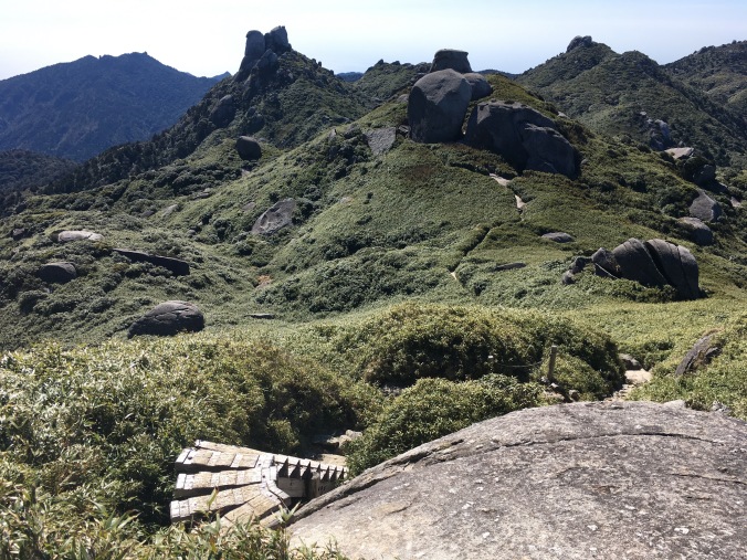
As for today, it’s bright blue skies! Departing Shin-Takazuka Hut around 6:15 AM, the hike is up and up and the trees get shorter and more twisted until you pop out around a corner to an amazing view and almost get whipped off the trail by the wind. I try to hold steady to snap a few photos and then am grateful to duck back into the safety of a grove of trees.
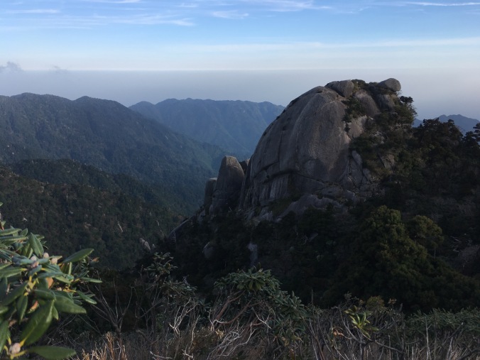
Yakushima’s Half Dome?

Trees eventually give way to short bamboo grass (which my mom says is like the high mountains in Taiwan – I will have to go see!) and bare granite boulders piled in interesting formations. Yakushima is basically a giant granite plug formed by magma pushing up above sea level. As you hike you can see how the granite is eroding; there are lots of little square pieces of white rock along the trail and you can see them in the granite boulders you walk past. A lot of the trail is raised on wooden boardwalk and stairs because where you put your feet the thin delicate soil will wear off and become a granite path water flows down. You walk through a lot of water, but it’s clear and not muddy because there isn’t enough dirt.
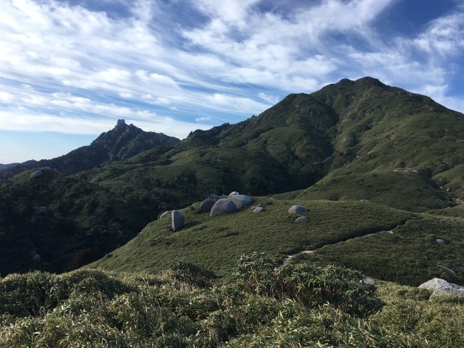
Looking back at the trail from where I came
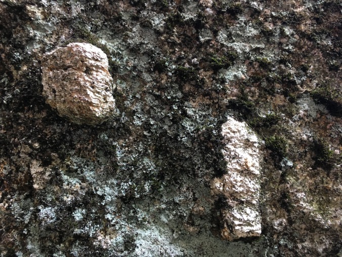
apparently these are potassium feldspar crystals
Three, maybe four, people left the hut in the same direction as me and I pass one and then wave to another a bit of a ways ahead of me, but otherwise I see no one else on the trail. The view is exhilarating and the rock formations fascinating and before I know it I’ve reached the top of Miyanouradake.
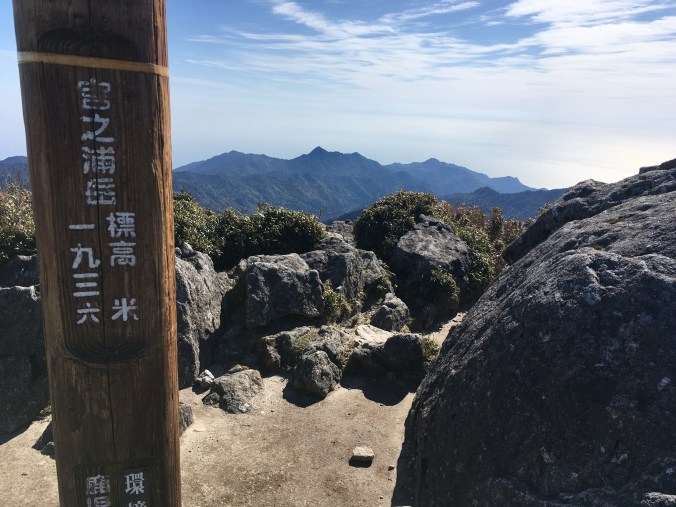
Miyanouradake: Kyushu’s highest peak at 1936 meters (6352 feet)
It’s 9 AM, so I’ve been hiking for almost 3 hours but it totally doesn’t feel that long even though it was uphill because it was so fun and my stoke level is super high. I have the peak all to myself. Not only do I have a 360 degree view to the sea on all sides, I can see the hazy line that is Tanegashima (種子島) on one side and a small more triangular shape of Kuchinoerabujima (口永良部島) on the other. I have a snack, some coffee, text Kiwi sig other that I am still alive and check the weather as cell reception comes in and out. Apparently, it’s supposed to start raining Thursday around noon, but the rain doesn’t look too bad, it’s not thunderstorms like on Monday. If it’s the last day of hiking, even if I get wet and cold I can warm up and clean up at an onsen at the end of the day. Hrm, still not sure where I’ll sleep tonight.
Then another hiker reaches the summit so I decide to head down to give him his own exhilarating top of the world moment. Going down from the summit the trail starts to get more and more wet and marshy, and I begin to see more people. Basic trail etiquette is that people climbing up have the right of way. As I step aside, I feel irrationally resentful of the people carrying daypacks to summit Mt. Miyanoura from Yodogo Trailhead since I somehow feel like I earned it more than them. I start to run into some mountain guides labeled by the ID tags hanging from plastic sleeves around their necks carrying very large packs and their group members carrying much smaller ones. I run into one such guide, smile, say “konnichiwa” and pull aside. He says, there are 30 people in our group, please go ahead where you can. I dodge through the crowd on the trail as if it’s Shinjuku Station. I think I whack a couple with my sleeping pad. WTF. Who hikes in a 30-person group? That would be my absolute nightmare.
View coming down off Miyaouradake. Note the famous Tofu-iwa (Tofu rock) on the right midground. I think it looks like a sliced mantou (饅頭 – Chinese plain white steamed bun).
Around noon, I drop my pack for the side trail to Kuromidake (黒味岳), where I again find solitude and enjoy having the summit all to myself. Coming down from Kuromidake, I run into 3 other folks. One is a gentleman from Morioka who stayed at Shin-Takazuka Hut the night before and we have a short chat about our plans for the day. (We had chatted about Morioka and Iwatesan yesterday because I’m also familiar with the area because I pass through quite a bit going back to my JET Program hometown in Akita.) I tell him about my dilemma about Ishizuka Hut versus Yodogo Hut and how checking the weather on Miyanouradake didn’t help me reach a conclusion.
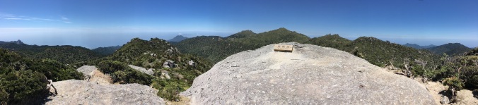
Panorama from the top of Kuromidake
I’m taking a break on a wooden platform at Hananoego (花之江河) junction when I see the guy from Morioka again. This is the junction where I can go to either Ishizuka Hut or Yodogo Hut. “I haven’t decided yet,” I say. He says after he saw me he had a chat with a nice young man who is a grad student in Kagoshima and that guy said he climbed Tachudake yesterday and it should not be missed. So his new plan is to stay at Yodogo Hut, hike the forest road to Yakusugi Land and climb Tachudake (太忠岳) tomorrow. Interesting, I say, that is a full day hiking option out of Yodogo Hut I hadn’t thought of. If he doesn’t mind me possibly glomming onto his plan, I guess I will stay at Yodogo Hut.
A third hiker we know from Shin-Takazuka Hut emerges from the bush. “Where did you come from,” says my new dad from Morioka (turns out he has three daughters in their 30s), “I thought you left earlier than we did.” The third hiker says he’d been hanging out by some rock formations all day. He asks, “Did you see that group of 30 go by?” I say, “Yes. Ugh. Hiking in a group of 30 would be my absolute nightmare!” He tells us, “I overheard they will be staying at Shin-Takazuka Hut tonight. Weren’t we lucky!”
It’s about 1:30 PM when the other hiker and I push on as dad from Morioka lays down for a nap. Photos don’t do Hananoego justice, it looks like a landscaped Japanese garden with ponds enclosed by moss carpeted marsh, framed by wind scarred and shaped white yakusugi, surrounded by mountains dotted with ornamental granite boulders.
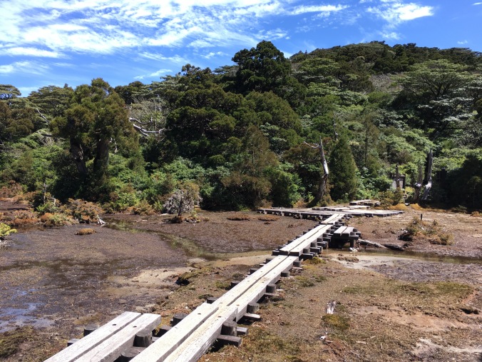
Hananoego, Japan’s southernmost alpine marsh
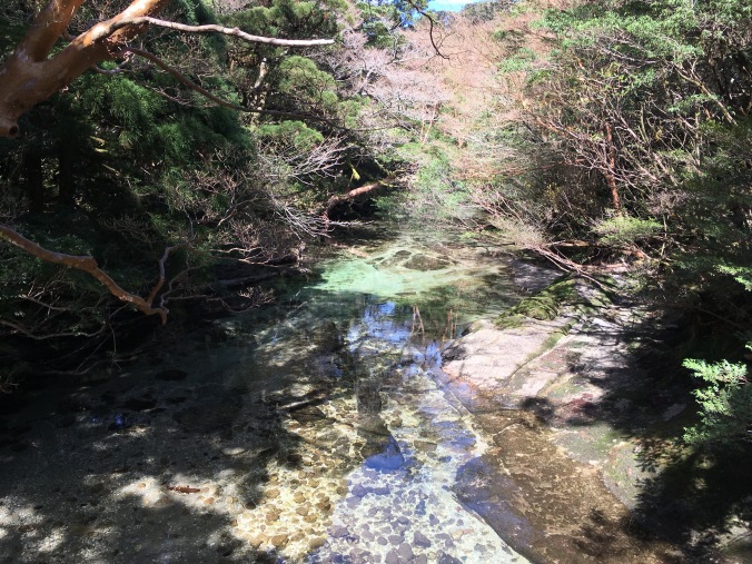
At 3:10 PM, I arrive at Yodogo Hut. Yodogo (I was corrected by another hiker who said in Yakushima dialect the word for river is pronounced “go”) is really pretty in the afternoon light. It’s shallow, clear as glass and tinted green from the foilage above it. I again claim a spot on the second floor of the hut, then steal a pair of slippers from the hut shoe cubby to use as camp shoes while I stick my socks and shoes in a patch of sun to dry. They are soaked from walking in water half the day. I’m snacking on Yodogo bridge, studying my map with my feet dangling over the water when another hiker points out two yakushima monkeys (smaller than normal Japanese macaques) grooming each other on a tree branch overhanging the river.
Over dinner, I listen in on the conversation between dad from Morioka and the other hiker from Shin-Takazuka Hut while sipping umeshu no oyuwari (hot plum wine), courtesy of my new dad from Morioka. Turns out they are both serious Hyakumeisan peak baggers pretty close to finishing. Dad from Morioka drove to Kagoshima all the way from Morioka. Yakushima is part of his trip to bag all the Hyakumeisan peaks in Kyushu, with the exception of Mt. Aso, the peak of which is still off-limits due to recent volcanic activity. The other hiker is now pretty much only missing Hokkaido. He tells a story of one time he went on a three day hike and got back to his car at the trailhead only to find he was trapped for three additional days because the forest road back to civilization had washed out. They exchange tips on how to modify your car for better shachuhaku (車中泊 — sleeping in your car) at the trailhead.
At 7 PM it’s hiker lights out. I haven’t seen any manmade structures all day except for trail, and even if there are the huts, there is no electricity. I wonder if I can see any stars. The thought seizes me. I crawl out of my sleeping bag and down the ladder, tiptoe past the other sleeping hikers and run out to Yodogo bridge. But with tomorrow’s cloud cover already coming in, I only see about the same number of stars I usually see in Tokyo.
Date: April 19 • Start: Shin-Takazuka Hut • End: Yodogo Hut • Distance hiked: 9.6 km Achievements Unlocked: first time multi-day hiking • bagged a Hyakumeisan
