When everyone’s packing up and leaving Yodogo Hut in the morning I catch dad from Morioka and inform him that, after sleeping on it, I have decided to take Onoaida Trail (尾之間歩道) and end my 3-day journey at Onoaida Onsen (尾之間温泉). I thank him for the confidence boost. If he thinks I can make it to Tachudake and back down to the 3-something PM bus out of Yakusugi Land, I should be able to make it down Onoaida Trail to the south of the island in good time. It’s going to be all downhill, right? I loved feeling like I was the only person on the trail yesterday so I’d like to go off the beaten path, I say. Before I really looked at any maps, my initial idea had been to hike north to south since my friends are staying at South Village, and I think there will be a sense of completion to say I hiked north to south across the island to meet them. He thinks its a fine idea and since we have both been hiking faster than the standard estimated course times thinks I’ll make it to Onoaida Onsen in 5 hours, which means I could probably finish before it starts to rain. We bid each other farewell and good luck.
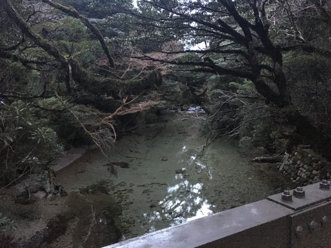
Yodogo at dawn
I arrive at Yodogo trailhead in less than an hour, use the toilet and ask the ranger about the weather. He asks me where I am going. I say, Onoaida Onsen, I hope to make it there before it starts to rain. The trail is long but you should not miss Janokuchi Falls (蛇之口滝) on the way down, he advises.
Yodogo Trailhead
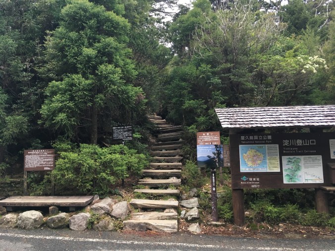
Onoaida Trailhead
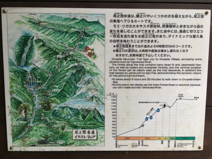
I study the trail description. 8.5 km down to the junction with Janokuchi Waterfall and then 3.5 km to Onoaida Onsen. “It takes about 6 hours and 30 minutes to walk down to Onoaida-onsen Spa.” Easy-peasy.
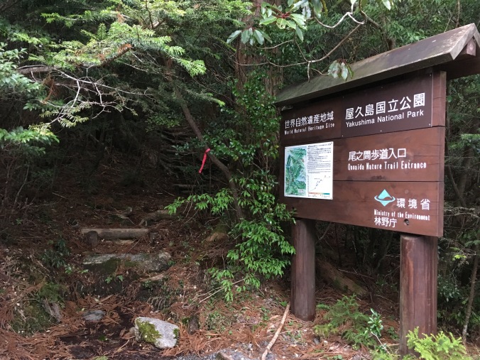
Description at Onoaida Trailhead
“Onoaida” means “between the ridges”. The little trail guide that came with my map, says Onoaida Trail is impassable if the water level at Tainokawa crossing (鯛之川出合) is high, there are numerous stream crossings and the trail may not be well-marked, GPS is advised. It has not rained in the past two days, so I figure I’ll be fine. As I hoped, the trail does not look well travelled, but I identify a set of fresh boot prints, and it is reassuring to know that at least one other person thinks the trail is passable today.
According to the hiking etiquette book I received at Shirataniunsuikyo (白谷雲水峡)trailhead, if you use trekking poles, you are supposed to put rubber caps on the tips of your poles to protect the environment. I didn’t bring rubber tips with me and though 90% of the other people were using rubber tips, no one had called me out so far, not even any of the licensed guides. I figured that staying safe and not spraining an ankle was more important than following the rules, so I used my poles with their normal carbide tips anyway, but I did try to keep my poles on the trail, on wooden boardwalk or gravely or hard rock surfaces and away from any tree roots or moss covered surfaces. This was no longer possible as the trail seemed to consist entirely of tree roots or moss covered surfaces.
It’s a few minutes past 7AM when I start down Onoaida Trail. By 8:30 AM, I reach what must be the lookout point to Nogidake (乃木岳). According to the map at the top of the trail, that places me about 3 km in and more than a quarter of the way down the trail. I’m making good time.
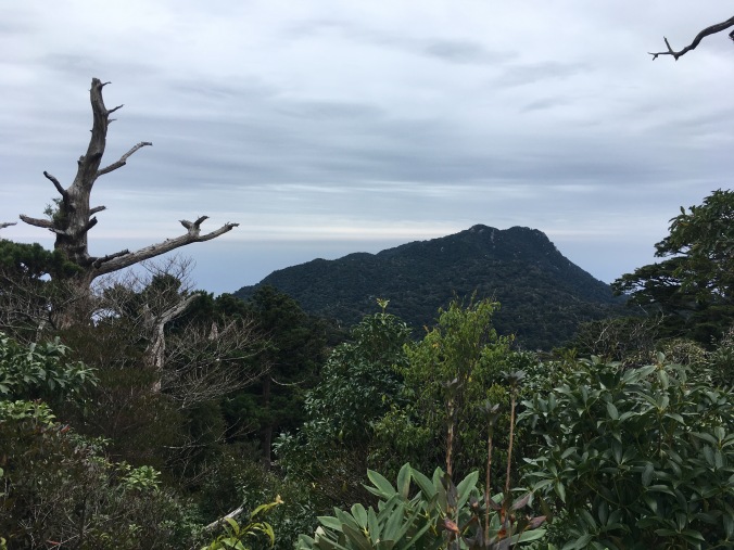
Nogidake?
So far Onoaida Trail is like a better version of Shirataniunsuikyo, with a lot of interesting mosses and fungi and other plant life.


About 9:15 AM I’m at the first stream crossing, I assume it’s Tainokawa and that I’ve made it another kilometer as I climb up the other side.


Then it’s an endless repetition of climbing down to a small stream, rock hopping across it and climbing up the other side. Except the streams get bigger and bigger as I head down.
The trail is well-marked with pink tape, though sometimes I reach one piece of tape and must spin around, tiptoe or duck down to find the next piece of pink tape. A few hours in I find myself turning a corner peering around for the next pink tape, locating it and exclaiming, “You’ve got to be kidding me!”
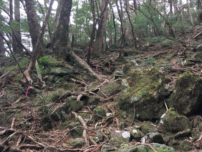
A sign along the trail explains that Onoaida Trail is an old logging route from the Edo Period (circa 1600), when yakusugi roof shingles were contributed by the locals to the lords of Satsuma Domain and up to first Toyotomi Hideyoshi and later the Tokugawa Shogunate. Since yakusugi are so large, they were cut into shingles at the site where the tree was felled and bundles of shingles were carried out of the mountains by people on foot. “Think of the labor of the men who laid out the stones of the trail,” exhorts the sign. A large part of the trail is a jumble of moss-covered stones. The trail description calls these “moss covered stone steps” which sounds very romantic and benign, but in reality, they do not resemble steps at all, they are slippery and there is no where to put your foot flat. In sections, it is obvious the trail has washed out leaving a red mud pit to climb around, or if that is not possible, down into and out the other side. I also climb over or under felled trees (at one point I almost have to take off my pack to get through). I slip and fall and scrape up my palm, bang up my shins, twist each ankle more than a few times and will later develop a giant bruise on my hip. (Later I learn that since it was a high snow year, the trail is probably in especially bad condition.)
It’s 1PM, I have been telling myself that I will break for lunch at the resting pavilion by the fork to Janokuchi falls but it is nowhere in sight. I’m starting to get worried. I’ve stopped observing the plant life along the trail and stopped taking photos.
I’ve already been hiking for seven hours, six on this god-forsaken horrible not-trail.
There’s a rustling in the brush and four young guys, probably in their early 20s and judging from their accents probably English, appear about 10 feet down the steep trail from me. The forest is so dense you can only see that far ahead.
“How much farther to the waterfall?” I ask hopefully.
“About one-and-a-half hours,” is the reply.
I can live with that. They say they are headed to Yodogo Hut for the night. I tell them I came from there and it’s beautiful. “This is a hard trail isn’t it? Does it get easier past the waterfall?”
“Not really,” says one of them and they proceed to tell me about how the trail is collapsed, they had to climb around it in part. Something inside me collapses in disappointment. I’d been hoping that at least the section of trail from Onoaida Onsen up to the waterfall would be better maintained since that should be the route for a day hike.
“It’s the same up ahead,” I say. “And there are a lot of stream crossings. You guys are the only people I’ve seen on this trail all day and I started at 7 am.”
“That sounds awesome!” one of them says and they plow on.
After they pass, I feel reassured that I am getting close to the waterfall and going to make it out of the woods before dark. Then, I start to feel bad that I didn’t emphasize more that its taken me over 7 hours to get here. Even if I am slow, I am going downhill. It’s going to be hard for them to make it to Yodogo Hut by nightfall; it’s already 1 PM, and it gets dark by 7 PM. Then, I rationalize: there are four of them, they looked like they had the right gear and they are young; they’ll survive.
Finally at 3:15 PM, I reach the pavilion at Janokuchi fork. I drop my pack and trekking poles under the pavilion, drink the rest of my water, stuff some granola cookie things in my face and take a break by running (okay walk briskly) to Janokuchi Falls. Without the weight of my pack, scrambling and hopping is a lot easier.
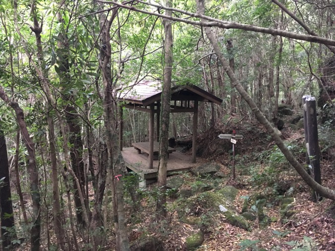
A welcome sign of civilization!
I’m at the falls by 3:45, spend a few minutes snapping pictures and head quickly back.
I’m still hoping to get a quick onsen before I have to catch the bus. I’m already going to miss the 3-something bus I initially intended to catch, but there’s another one at 5-something.
I’ve started talking to myself. I’m praying to the weather gods out loud: “Thanks for all the awesome weather this trip so far. Thank you for holding off the rain. Please keep holding off the rain.” I’m cheering myself on: “Go team! Good job, Ankles. That’s it, Knees. Just hang in there for another hour. We’ve all been together 35 years and no one has failed us yet. Guess what? We are pretty bad ass! I promise to take good care of you. (When this is over.) We’re going to the onsen!”
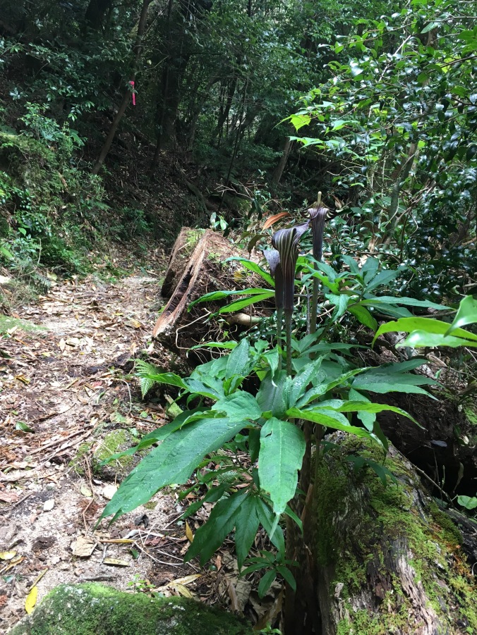
The four guys were wrong. The trail following the fork to the waterfall is much easier. Wider and obviously much more travelled. Once you descend a certain elevation the trail becomes loamy and soft, as there is actual soil (including 1 meter of volcanic ash from a nearby explosion 6300 years ago) around the perimeter of Yakushima. The vegetation becomes subtropical and there are palm trees and interesting tropical looking flowers.
At 5:30 PM, I emerge from the bush into the parking lot of Onoaida Onsen. Finish! I sit on a bench in front of the building for a minute and check my bus schedule while the stray cats fed by the guy at the front desk mill around. Great! If I’m in and out in 20 minutes I can totally make the bus.
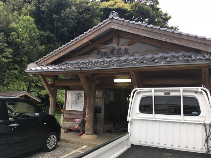
Onoaida Onsen
Onoaida Onsen is written up as “very hot, I don’t know how locals manage to get in” even on Japanese review sites because the spring water comes out of the ground at 49 degrees (Celsius) and the bath is about 46 degees. Whatever, I spent the entire winter bathing almost exclusively in the soto-yu at Nozawa Onsen (average temp around 45) and now think normal onsen temp of 40-42 degrees is nurui (not hot enough). The atmosphere is also a bit similar to the soto-yu at Nozawa Onsen. You have to bring your own soap and towels and while there are a couple shower nozzles, they are exclusively for hair washing. I wash myself like the locals using the bucket method with the hot water directly from the tub in the manner I picked-up in Nozawa. Onoaida Onsen is very barebones but the current wooden building is relatively nice and new and I liked it a lot.
As I’m leaving the onsen, it finally starts to rain. Finally, my rain jacket comes in handy. It’s a 20-minute walk down the road to the main road that circles the island. I make it to the main road just as a bus is about to pass. I flag the bus down, but it’s not the right bus! Turns out I read my bus schedule wrong and missed the bus I wanted to catch. It’s about 6:15 and the next bus going as far as Hirauchi (平内) isn’t for another hour. It starts to rain harder and I retreat to an abandoned vegetable stand alongside the road for shelter to consider my options. I guess I can wait for an hour as it grow dark, or… I can hitchhike?
I’ve never done this before, but I stick out my thumb and the third car picks me up. My driver is a super cool single-mom artist who lives in Hirauchi and makes hand-dyed and hand-sewn clothes. She says she’s originally from Shizuoka but drove down and across Japan looking for a new place to live and when she got to Yakushima, she knew this was the place for her. She drops me off at the hostel and gives me her number to keep in touch.
I check in to South Village and contemplate staying in a bunk instead of setting up my tent in the rain, but a bunk is three times more expensive than a campsite and campers get access to all the same common facilities. I’ve also hauled my tent for three days all the way across the middle of the island. The campsite is composed of raised wooden platforms, so I give myself a crash course in setting up my tent with concrete blocks and rocks instead of stakes. I manage to do okay. My friends Tina and Brig left me a nice note in front of their tent that they went to Hirauchi Kaichu Onsen. I go to the guesthouse to use the hair dryer, do a load of laundry, and forage for some food. Brig and Tina get back, we all eat dinner together and then watch Kiki’s Delivery Service on the big screen TV in the guesthouse. We turn on the heater. It’s basically glamping. We retreat to our tents at about 11 pm and I look forward to not hiking anymore tomorrow.
Date: April 20 • Start: Yodogo Hut • End: Onoaida Onsen • Distance hiked: 13.2 km
Achievements Unlocked: survived Onoaida Trail • survived not showering for four whole days • hitchhiked for the first time ever!
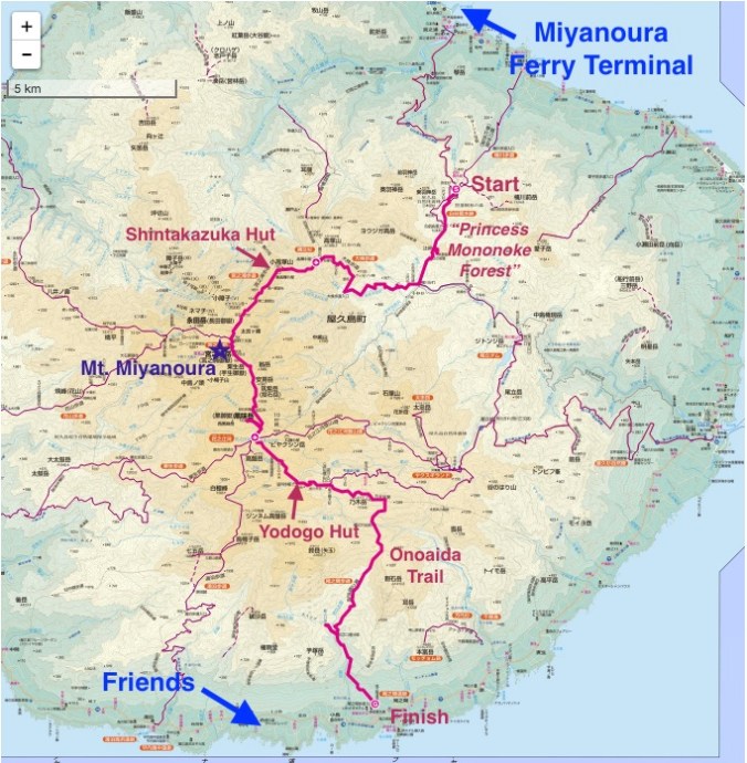
Bonus: Here’s a map showing the hike I completed. (Kiwi sig other thinks this makes my story make more sense.) Trip data and gear reviews to follow.

Love your writing; what an adventure! And most helpful too, details such as the mountain huts and time of lights out/on. Thank you for them. I’m still debating whether to do a thru-hike of Mt Miyanoura with my 11 year old daughter!
LikeLiked by 1 person
Thank you once again; thought you might like an update (and perhaps to other readers-hikers researching on the trails). We hiked from Yodogawa Trailhead towards Mt Miyanoura — this was in middle of March. There were many snow patches; my 11 year old (physically quite fit; she runs and rock climbs) slowed me down by making snowballs and playing with icicles; but otherwise we were good. We did an out and back hike as I decided against a thru-hike (we would have to pack a lot more for that, it was still early spring — so would be cold, etc). We carried minimal gear. And absolutely lucked out with the weather. She was tired at the end of it; some parts of the hike being quite technical with roots, but we did it in good time (we didn’t even start that early!).
LikeLike