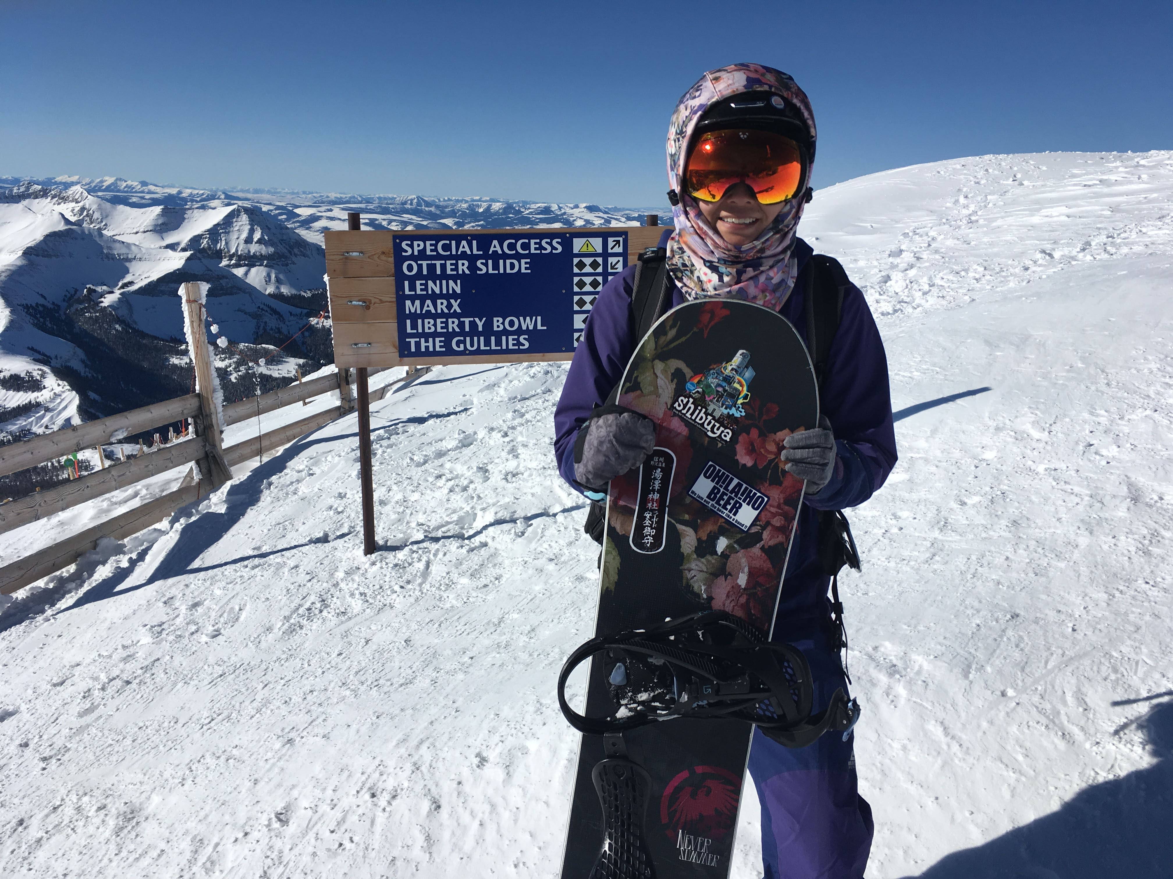
Video: How to JMT | How to Pack a Backpack

As COVID-19 skill building, I made a YouTube video! In the first of a series of videos I imagined while hiking the JMT, I present “How to JMT: Pack a Backpack”:

Future topics may include how to:

  • dig a cathole
  • prevent blisters
  • use your pack to level an uneven sleeping spot

You can read more about the gear I used on the JMT and my gear philosophy (totally not fussed) at this previous blog post.


JMT 2019 Day 1: Return to Upper Lyell Base Camp

IMG_4343

September 4, 2019
Tuolumne Meadows to Upper Lyell Basecamp (11 mi)

I set off from the Tuolumne Meadows backpacker campground around 7 am, foregoing hot breakfast at Tuolumne Meadows Grill which doesn’t open until 8 am. Lyell Canyon is gorgeous of course, with the river running over bare granite and open meadows just starting to yellow for fall. The forecast posted at the the general store said thunderstorms after 11 am, so I want to get as far as I can by then.


The trail up Lyell Canyon, a classic U-shaped glacial valley, is pretty flat. My pack, loaded with 7 days of food, is manageable but not comfortable. Every hour or so my shoulders start to cramp up. But if I take a short break I quickly recover and am able to keep going again. It hails a bit, but when I finally pull over and duck under a tree to put on my rain jacket, it stops. And that is the function of rain jackets, e.g. if you don’t bring one, it will definitely rain.

IMG_4351

After a leisurely 300 feet of elevation gain over almost 10 miles, suddenly you reach The Wall, and begin to climb what feels like straight up out of the valley. I leap frog with a couple other solo lady hikers and reach my intended campsite at Upper Lyell base camp just before 3 pm. I could have hiked farther but I don’t think I want to continue on up Donohue Pass before eating some more of my food (and lightening my pack)!

This is the same campsite Jackie and I camped at in 2017. This time it is warm and pleasant instead of deathly cold. The bad thing is mosquitos definitely gather when the wind dies down. Good thing the location tends to be very windy from the katabatic winds coming down from the pass. When I camped here in 2017, the wind snatched the gray stuff sack for my tent when I unpacked. Blown into a landscape of gray granite, the stuff sack was lost forever. Since that day, I have preferred bright colors for my outdoor gear.

After setting up camp, I roll out my Thinlight foam pad to do some yoga and promptly roll my right ankle on a tuft of grass. First day of my hike and of course I injure myself when I’m not even hiking!

I am sitting on a rock in the breeze writing in my journal when Larry rolls up, followed soon after by Ellen, both also hiking solo. These are my campsite mates for the night and we have dinner together. Larry is talkative, wears bright compression socks and works for one of the big four accounting firms. Ellen is a former athlete with a career in sports medicine. In her 60’s and having sustained injuries and worn out her body over the years, she hikes completely hunched over her trekking poles in jerky movements, overcoming pain with pure tenacity. She’s an experienced mountaineer, warm and funny, packs a handle of whiskey and is a total bad ass.

IMG_4359

View of Donohue Pass from my campsite.

2017 Upper Lyell Basecamp

Same exact view September 23, 2017. The small lake is actively freezing over after the sun dropped down behind the mountains to the west.


JMT 2019 T minus 1: Lone Pine to Tuolumne Meadows

September 3, 2019

IMG_4322

I catch the 6:15 am ESTA bus from the Lone Pine MacDonald’s, which is full of backpackers repacking their packs at 6 am. I have left my car in the overflow parking of the Historic Dow Motel, which provides long-term parking to its guests. (Another place you can park while you hike for a small fee is the Museum of Western Film History.) I chat with my seatmate who has just completed the entire JMT in ten 25-30 mile days, waking up every morning at 4:30am. He says it was a sufferfest and he wishes he had gone slower so he could remember more parts of it. Most of the other folks on the bus have just finished the JMT or other hikes in the Sierra and are heading north to Reno to fly out to wherever they are from, including England and Australia. I am dropped off with one other hiker at Tioga Gas Mart at the turn off for Tioga Pass to catch the YARTS bus into Yosemite. (This is not an official ESTA stop on their website but when you make a phone reservation — which is advisable because the bus I was on was full — and tell them you are transferring to YARTS, ESTA will stop at the YARTS stop.) I feel nostalgic as I walk into the gas mart to use the restrooms. Last time I was here, I was miserable at the prospect of not being able to finish the trail.

The YARTS bus drops me off at Tuolumne Meadows just after 10 am. The Tuolumne Meadows store and campground feel like familiar ground. I go and stake out a campsite in the backpacker campground, setting up my tent and stashing my food in a bear box. Pack lightened, I hike over to the wilderness center to pick up my permit.

img_4324

They give you a wag bag for Mt. Whitney when you pick up your JMT permit. I dutifully carried it to Red’s Meadow and dropped it in the hiker box with all the others. Then I picked one up from the hiker buckets at Mt. Williamson Motel in Independence. Should have just left the first one at Tuolumne Meadows.

I make a loop around Tuolumne Meadows, covering the two miles we skipped last time to hitchhike to the post office before it closed. I visit Parsons Lodge and listen in on some ranger talks, learning about habitat restoration in the delicate alpine meadows and the importance of not going off trail. I take a taste of Soda Springs and walk towards Lembert Dome. An ominous cloud builds up over the mountains to the south, and I abort the idea of climbing Lembert Dome to go hide in my tent.

IMG_4335

Yay! Back on the trail!

img_4340

Lembert Dome

It thunders and hails but doesn’t rain much. When I set up my tent in the morning, mine is one of two or three tents set up in the backpackers’ campground. When I emerge in the afternoon, it is full, with excited hikers happily welcoming late comers to share campsites. In the evening, folks stroll around the backpackers’ campground, beer in hand, in a home and garden tour of the most popular backpacking tents on the market. A young European couple is in some kind of cuben fiber (oh, I’m sorry, DCF) spaceship that we all ooh and aw over.

There is a campfire talk in the evening about glaciers and the Q&A inevitably turns political. It’s a pleasant surprise and comforting that the NPS is still allowed to talk about climate change as a fact, though of course the ranger is mostly preaching to the choir. It ends with a super awkward rap with a refrain that she makes us sing along: “ice, ice, baby…. melting.”

*** ***

Looking back at my journal to write these posts, I noted between the entries for September 2 and September 3 simply:

Sunrise 6:23 AM
Sunset 7:16 PM

This was from the weather app on my phone so I would have an an idea of how long I had each day to hike. I knew I would lose cell reception after Lee Vining. Cell reception on the JMT is very limited. Tuolumne Meadows has Verizon, but at the time I was on an AT&T based carrier. When I left for the trail, friends said things like “Looking forward to reading your blog posts from the trail!” and I didn’t have the heart to tell them I wouldn’t actually be able to blog from the trail. I will randomly find great reception at a campsite near Trinity Lakes and post a couple photos to Instagram, and when I get to VVR, I will walk out onto the dam to text my emergency contact that I am on schedule. There is cell reception at the top of Kearsarge Pass which I will use to call and leave a message with Mt. Williamson Motel that I am on my way and that I want to take a zero and stay an additional night. That’s it. I didn’t carry any kind of satellite emergency communication device, but I met a lot of people who did. If I saw someone with a Garmin InReach hanging from their backpack shoulder strap, I would sometimes ask if they had the weather forecast. Not being connected is one of the best things about backpacking and going deep into the wilderness. I suspect it’s why I’m only able journal consistently out there.

JMT 2019 T minus 2: From the Rockies to the Sierra

September 2, 2019

I tried to listen to An Indigenous People’s History of the United States while driving across the Great Basin, because you can’t help but see how inhospitable it is and the presence of reservations, casinos and brothels evince a certain history… but the history is too sad and enraging. Instead, I listen to American Wolf and think fondly of the Greater Yellowstone Ecosystem that I’ve been privileged to live in and will be going back to.
I am driving over 1000 miles from Big Sky to Lone Pine, from the Rockies to the Sierra over dry and desolate shrublands, so sparsely populated. It’s the kind of landscape that makes you worry about whether you are going to make it to the next gas station and where the marks of capitalism and globalization, bright highway signs of McDonald’s and Chevron, simply feel welcoming and comforting and familiar.

I camp at Carlin Canyon in my car, with the windows open a crack and it is comfortable and I sleep well from 10pm to 6am. I wake up, duck behind a bush for a pee, make some coffee on my backpacking stove and am on my way. I stop at the next rest stop to poop and pick up a hitchhiker holding a gas can and take her to the next gas station. 

I drive until I am tired and hungry but not hungry for any of the food I have. I pull over for a rest but it’s too hot to turn off the AC. There is no shade, just desert-y hills for hundreds of miles. 

Finally, I cross the border into California and the Owens Valley. I contemplate detouring to Lee Vining, which I remember fondly from my 2017 JMT thru-hike attempt. But is it out of the way, and I will pass through it tomorrow. As I drive south toward Bishop I can barely see the Sierra due to smoke from nearby fires. At the Vons in Bishop, I get wifi and inquire on the Ladies of the JMT Facebook group and am assured that the current fire situation will not have an impact on my hike. 

It starts raining as I leave Bishop. The rain washes the smoke from the valley air and reveals the peaks of the Eastern Sierra, looking harsh and intimidating shrouded in storm. At Lone Pine, Highway 395 is at less than 4000 feet. Mt. Whitney tops out at 14505 feet. It’s going to be a big descent at the end of the trail. And I am going to have to climb down to the Owens Valley and back up to the Sierra crest for my resupply in Independence.

A COVID-19 Reading List


“You have reached the Montana Unemployment Insurance department, due to unforeseen circumstances we are unable to take you call right now. Please try again later…beep beep beep”

It’s been over two weeks since the Grand Targhee Resort suddenly closed and I joined the masses of people trying to apply for unemployment due to the COVID-19 crisis to no avail. I’ve been splitboarding as much as possible, trying to do it responsibly, meeting partners at the trailhead instead of carpooling and staying 6 feet apart and keeping objectives super mellow to minimize risk of avalanche or injury; finishing some latent crafting projects; cooking; walking the dog, who is happy he has someone for post-breakfast cuddles; and scrolling my phone… I’m starting to feel the uncontrollable urge to pick fights with friends of friends in ridiculous arguments about face mask use and the coronavirus stimulus package. I think it’s time for #socialmediadistancing. So, here are a few books I’ve read and enjoyed in the past year that I think are relevant to the current situation. (Click the photo of each book for my Amazon affiliate link.)

The Fifth Risk

This 2018 book examining the transition to the Trump Administration after the 2016 election was terrifying when I read it last fall, but now it just seems prescient. The book argued that the biggest problem with the Trump Administration is not just blatant corruption and crony capitalism but how the systematic gutting of the federal administrative agencies is exposing the country to unprecedented risk. With stories of the unsung heroes in the federal bureaucracy whose unsexy and low paying (compared to the private sector) jobs keep everything we take for granted working, Lewis’ book was a Cassandra-esque plea for the importance of government and governance in the face of neo-liberal orthodoxy that “government is the problem, not the solution” and a bunch of cynics who thought it would be better to elect Trump and “burn it all down” rather than vote for Hilary and politics as usual. And here we Americans are: in the middle of a global pandemic with no coherent strategy, lacking basic healthcare supplies, while the President of the United States of America spreads unscientific misinformation and acts like a mob boss. We are now reminded that government is not just the egos of the flip-flopping, power-hungry politicians we all love the hate, but should be a provider of essential services to keep our communities safe and functional.

This Changes Everything

Naomi Klein’s book argues that neo-liberal capitalism and market globalization are fundamentally incompatible with taking any serious efforts to address the climate crisis. We need to fundamentally rethink capitalism, shed our growth for growth’s sake mindset and realign our values if we are going to save human civilization (not the planet, folks!) from the climate crisis. She challenges conventional market-based solutions like cap-and-trade, dashes our hopes for a billionaire technologist savior, criticizes big green non-profits for selling out to greenwash major polluters (including oil and gas companies), and argues that environmental issues are social justice issues. For example, what is good for climate is not NGOs in rich countries buying up the Amazon rainforests for cap-and-trade and fencing off the indigenous people from their subsistence way of life, but allowing those people to live their more sustainable lives without pressuring them to join the global economy and burn down the rain forest to farm beef for MacDonald’s hamburgers. A lot of her ideas may have sounded very extreme until a couple weeks ago, but if we are willing to shut down the global economy for COVID-19 when convinced it is a matter of life of death, what if we treated climate change like the matter of life or death which it is? And in the midst of the current economic shut down and sheltering in place, can’t you start to imagine a life not defined by consumption and an identity not defined by your job?

Eleanor Oliphant is Completely Fine

A funny, entertaining read about a cynical, narcissistic woman who lives a life of extreme social distancing and doesn’t deign to conform to social norms, who discovers what it means to have friends and confront your deepest fears.

Maybe You Should Talk to Someone

A therapist goes to a therapist. I read this to try to find out “what is talk therapy?”, since I am interested in trying it. We might all need some therapy after this crisis. Also, funny, relatable personal stories will help restore your faith in humanity if your local mutual aid volunteers haven’t already.

Food / Logistics Planning for the John Muir Trail

If I could eat whatever I wanted while hiking, it would probably be potato chips. Fat, carbs and salt delivered in crunchy deliciousness… Unfortunately, potato chips are bulky and won’t fit efficiently in a bear can. Boo. I am going to be eating a lot of potato chips right before my hike and when I get to my resupply points.

A JMT food plan is basically a JMT logistics plan. There are limited options to resupply along the John Muir Trail. If you start from the traditional beginning of the trail at Happy Isles in Yosemite Valley, the first possible resupply point is Tuolumne Meadows (mile 22.8), then Red’s Meadow Resort (mile 60), then Vermillion Valley Resort (junction at mile 88 with a number of options to get there), and Muir Trail Ranch (mile 110) is the last on-trail resupply point. After that, your options are to (1) book it to Whitney Portal in 10 days or less, because all your food has to fit in a bear canister, (2) hike down to town via a lateral trail (most commonly over Kearsarge Pass to Onion Valley), or (3) pay for a horse packing outfit to do a food drop or recruit some friends to hike your food up to you (also most commonly at Kearsarge Pass).

To make a JMT food/logistics plan, I first made a loose itinerary of my hike to figure out how many days of food I would need and where I would resupply. I plan to hike an average of 10-12 miles a day and used the Wenk book to review trail descriptions and figure out where I might want to camp each night. I am starting from Tuolumne Meadows, and estimate it will take me 7 days to reach Vermillion Valley Resort from there and then another 8 days to reach Onion Valley and 5 more days to exit at Whitney Portal.  The private businesses that serve as resupply points along the trail each charge different fees and have specific instructions for sending resupply packages. So, I made some tough decisions, like “Do I want to spend $40 for the privilege of sending a package with only 2-3 days food in it to Red’s Meadow?” (No, I’ll suck it up and carry a bit more food and if I am short I can eat more burgers at Red’s and supplement from the General Store.) and “Do I really want to spend $265 for the Full Resupply Package at Mt. Williamson Motel?” (Yes, I may need some pampering by then…).

Here is what my resupply plan looks like:

LocationNo. of days foodBreakfastLunch/SnacksDinnerNotes
Tuolumne Meadows (Start)6+1 breakfast666
First day brekkie in civilization, Nero at VVR — possible to get food from Red’s if short
VVR8787
First day brekkie at VVR, last day dinner in Independence
Onion Valley5454
First day brekkie at Mt. Williamson Motel, last day will be back in Lone Pine!
TOTAL171917
Resupply packages I sent myself in 2017. Only sending two packages this year.

As for what I am eating, I am not being too fussed about being healthy or calorie counting. The JMT is only going to take me 3 weeks so I can’t really malnourish myself. Based on rough calorie estimates from the backs of food packages, I’m trying to bring about 2500 calories per day. Since how much food you can bring on the trail is limited by the size of your bear can, you want to bring calorie dense food. Fats are the best. The other thing I am trying to do is fatten myself up before the trail. When backpacking, generally I like to have hot dinner and breakfast (since I need to boil water to make coffee anyway) and then I just snack throughout the day without eating a real lunch. Here’s a list of what I will be eating on the trail:

Breakfast
Coffee (Starbucks Via)
Coconut Oil Packets (Trader Joe’s)
Nido (whole milk powder)
Granola
Instant Oatmeal
Freeze dried fruit

Lunch/Snacks
Tuna Packets (in oil for more calories)
Peanut Butter packets
Nutella Packets
Hummus
Cheese
Summer Sausage / Pepperoni
Tortillas
Prunes
Dried Apricots
Crasins
Nuts
M&M’s
Fruit Leathers
Meat bars (Epic)
Cliff Bars
Candy Bars

Dinners
Olive Oil Packets
Idahoan Mashed Potatoes
Tuna Packets
Chicken Packets
Mountain House and Backpacker’s Pantry dinners
Non-caffeinated tea
Hot Cocoa

If you’d like to learn more about food planning for the JMT, here are a couple great resources:

I also have a great JMT trip planning Google sheet I inherited from a friend, who inherited it from another friend, that I am happy to pay forward if you PM me.

JMT 2019 Gear List

Gear Philosophy

It seems like long-distance hikers, thru-hikers, ultralight hikers and outdoorsy people in general like to talk about gear too much. I think this is because (1) it’s easier to shop for gear online than to actually go outside and train in preparation for an objective and (2) reviewing gear and talking about gear and wearing and raving about sponsor’s gear is how all the “influencers” make money.

I feel very ambivalent about people bandying around numbers about how big the outdoor industry is and how it should have more political clout. As much as I appreciate what Patagonia does in sponsoring creative endeavors like The Dirtbag Diaries and fighting for Bears Ears, I don’t think that we can spend our way out of the environmental crises, no matter how environmentally friendly your camp shoes are. What we need to do is what they used to teach in elementary school back in the 80’s, before environmental issues were so politicized — Reduce, Reuse, Recycle. (Patagonia realizes this too.)

The outdoor community in the United States is very white and very privileged. People often talk about camping and backpacking as if it is free! Outdoor gear is very expensive and obsession with the latest and lightest gear can make costs appear even more daunting and insurmountable for #unlikelyhikers just trying to get into the outdoors. Having the right gear is important. For example, having a sleeping bag that is warm enough and light enough and not too bulky will definitely be key to an enjoyable backpacking experience. But, shaving off a few grams from your pack weight by buying a $20 titanium spork?… Probably not necessary. (Full disclosure: I had said titanium spork and am still sad I lost it. Still hoping it will turn up.)

When I started putting together my backpacking gear in 2016, I did buy nice, fancy, lightweight “Big Three” — pack, shelter and sleeping bag — after intensively researching the interwebs. And, I have been really happy with those choices. However, the rest of my kit was developed over time by cobbling together stuff I already had (my tiny Thermos was initially purchased to be a purse Thermos for commuting to work) or by trying the cheapest option (I still use a BRS stove) and gradually buying more expensive pieces as I figured out what would actually enhance my quality of life on the trail, e.g. moving from a Chinese knock-off Thermarest Z-lite sleeping pad to a real insulated inflatable pad. If you are interested in putting together a beginner backpacking kit on the cheap, PMags’ blog is a great resource, as he says “[t]he best way to learn about backpacking is not discussing gear online or going to gear sales but is actually to get out there.”

Without further ado, here is my JMT gear list.

JMT Gear List

Big Three

  • Pack
    • ULA Circuit  — My pack was once purple, but now it is faded to blue after a summer being used as my guide pack on the Matanuska Glacier. Many ice tools and ropes have been carried on the thing.  Also good as a carry-on on planes. Super simple design but very functional, the only thing I have not been able to figure out how to do with this bag is rack a splitboard onto it. IMG_6043
  • Shelter
    • Six Moon Designs Lunar Solo — No tent poles so ultra squishable and packable. Uses one trekking pole. Large floor for spreading out gear. Not free standing, but I’ve never had an issue setting it up with rocks, and it sheds wind super well, better than a dome shaped tent.campsite
    • Tent accessories: Tyvek ground sheet (purchased from SMD along with the tent), 8 stakes (assorted — bought the SMD tent stake set initially, but have lost some and cobbled together others over the years) and two short pieces of tent cord (2 meter and 3 meter) for guylines.
  • Sleeping System
    • Enlightened Equipment Revelation 20 Degree Down Quilt — This is literally the best thing I have ever purchased. It warms up super quick when it is cold, and unzips flat like a blanket when it is warm. The nylon shell is remarkably soft and comfortable. As an itinerant person, I sleep in this year round. I cannot go back to a sleeping bag. If forced to use a sleeping bag, I unzip it all the way down and use it like a quilt. In 2017, I was worried 20 degrees wouldn’t be warm enough and bought a sleeping bag liner and hated it. It twisted up around me negating all the wonderful things about a quilt. I’d rather just pack thicker long johns and my down parka to sleep in. Some people say quilts are drafty, but I think there is a lot of user error. The neck drawstring is key and you must wear a hat.
    • REI Co-op Flash Pad Regular — R Value of 3.7 at 15 oz and less than $100 when REI is having a sale. It’s been good so far. I purchased this after the JMT in 2017 after discovering that I cease to be able to sleep on a Thermarest Z-lite closed cell foam pad if temperatures drop below freezing, also sleeping on a Z-lite was messing up my hip flexors because they weren’t able to recover in the night. I will let you know about durability after this thru-hike attempt.
    • Sea to Summit Aeros Premium Pillow Regular — Fabric-y surface hides the fact that it’s just an inflatable pillow. When I started backpacking, I used extra clothes rolled up in a fleece jacket for a pillow. I purchased a pillow before the JMT in 2017 with the thought process, “If I have to wear all my clothes to sleep to stay warm, I won’t have a pillow.”
    • Gossamer Gear 1/8 inch Thinlight Foam pad – NEW! Trying this as a sit pad / yoga mat / extra sleeping pad protection/insulation / emergency sleeping pad in case inflatable pad springs a leak — I’m paranoid about leaks because last time I hiked the JMT, I was still super hard core and using an indestructible Thermarest Z-lite closed cell foam sleeping pad but it wasn’t warm enough once temps dropped below freezing.

JMT campsite 2017

What I looked like camping on the JMT in 2017. My quilt is draped over my tent to dry out a bit over breakfast before we pack up.

Clothing

  • Hiking Clothes (Worn)
    • Smartwool 150 T-shirt – NEW! Was going to slum it and wear any old synthetic T-shirt but splurged on a merino wool tee for its anti-stink quality. I have 7-day and 8-day stretches planned for this trek, which will be the longest I have ever been without a shower.
    • Montbell Chameese lightweight fleece jacket
    • Target sports bra and synthetic underwear
    • Northface Aphrodite Pants – Lightweight, quick drying, legs roll-up easily for stream crossings. I think it’ll be cool enough in September to prefer hiking in pants, and pants provide protection from brush and bugs.
    • Baseball cap
    • Sunglasses – random gas station, but polarized
    • Darn Tough Micro Crew socks – I used to have two pairs of Smartwool hiking socks, and two pairs of Smartwool ski socks, but the hiking socks wore out and I replaced them with two pairs of these Darn Tough hiking socks, which are just starting to show wear after 2 years of much more use than the Smartwool socks ever got. I still prefer Smartwool ski socks though.
    • Shoes – I currently own and hike in New Balance Leadville trail runners and Merrill Moab Mid GTX hiking boots. Not sure which I will want to wear and both are getting kind worn, but I think it is risky to break in new shoes now. Leaning toward the hiking boots for a bit more water resistance. I have just purchased new Superfeet insoles to put in which ever pair I choose.
  • Rain Gear
    • Outdoor Research Women’s Aspire Jacket – I have a pretty uncanny ability to make it not rain on multi-day backcountry trips, so I do not have strong opinions on rain jackets. (Tina vs. Whittier — the wettest city in Alaska and the United States, according to Wikipedia — 1 day of rain out of 9 on three separate three-day kayaking trips. Dry rain does not count.) The lining of my old Northface rain jacket started delaminating and ripping so I bought this one because it was very well-reviewed. Will let you know what I think after the JMT.
    • Montbell Versalite Rain Pants – Will shred upon contact with pretty much anything. (Patched with a lot of Tenacious Tape from the one time I tried to wear them on the glacier.) However, super light and useful as extra warm layer, mosquito barrier, pants to wear while doing laundry.
  • Sleeping Clothes
    • Uniqlo Heattech extra warm long johns
    • Uniqlo Heattech extra warm long sleeve undershirt
    • Extra underwear and socks (one to wash, one to wear)
  • Warm stuff
    • Uniqlo Ultra Light Down parka – Inga Askamit, author of Highs and Lows on the John Muir Trail is a fan too. But last winter they started only selling a seamless parka and my friend’s mom who works at Uniqlo warned me that the baffles in the seamless jackets will separate after a while because they are not sewn so that jacket is much less durable.
    • Merino wool Buff – functions as warm hat, balaclava, ear muffs and sleeping eye mask as needed.
    • Hestra Touch Point Warmth Glove Liners —  Merino wool synthetic blend. Expensive, but I got with a Big Sky gift card and they managed a whole season of ripping apart and applying skins to splitboard before developing any holes, which I will darn before the trail.

Water System

  • Sawyer Squeeze filter
  • One 2L Sawyer Squeeze Bag for collecting dirty water
  • 1L Nalgene Bottle – for drinking out of, and can function as a hot water bottle for cold nights, I don’t anticipate carrying more than 1 liter of water at a time for most of the trail.
  • 2L Evernew water bag – for carrying extra water and as back-up Sawyer Squeeze bag
  • O-ring that came with the filter for backwashing
  • Contemplating bringing Aquamira for back-up, as I expect to camp in below freezing temps at some point and am a little worried my filter will freeze like last time. Of course, I know now to not filter water first thing in the morning when it’s really cold. Filter before the sun drops below the horizon and everything freezes, then put it in your puffy jacket pocket and sleep with it.

Food storage

  • Bear Vault 500 Bear Canister – A bear canister is required on the JMT. It is heavy and makes my pack bulge a uncomfortably. It takes up most of my pack, so as I eat my food, I will gradually stuff more and more items in there during the day. In the Sierra, bears are very habituated to people and bear cans. In 2017 when we picked up our JMT permit, we were advised by the ranger in Yosemite National Park to place our bear cans close to our tents (12-15 feet away?), within sight and to make noise and scare the bear off if one approached… Very different from bear can protocol in Alaska or Montana where there a grizzly bears. Bears are super smart and adaptable, so when in doubt, ask the local rangers what it the best policy. Bear cans are not odor proof. The purpose of bear cans is to keep bears from being able to get to your food (bulky round shapes keep bears from being able to crush them with their jaws) and in the long run train them to leave campers alone. If a bear asks to borrow a nickle or a credit card, don’t give it to him!

Camp Kitchen

  • BRS Ultralight 25g Backpacking Stove – Cheap, made-in-China stove that may be less efficient than a fancy Jetboil, but is much more packable.
  • 700ml Evernew Titanium Pasta Pot – I started out with a larger aluminum pot, but figured out that I am pretty happy boiling about 600ml of water for dinner and a hot beverage (coffee in the morning and tea in the evening), so I upgraded to this little titanium pot which fits a small 4 oz fuel canister.
  • Bic mini lighter
  • GSI Outdoors Long Essential Spoon, Large – NEW! Trying this out because silicon spatula sides sound good for cleaning out pot without awful scraping noise. Long spoons are popular for getting food out of the bottom of Mountain House meal bags. It looks kinda ridiculous next to my tiny pot though.
  • Small ~330ml Thermos – Almost lost this hitching out of Lee Vining in 2017, but had the foresight to exchange contact info with the nice English mother-daughter pair that picked us up and got it back! Was sad hiking 4 days without the Thermos, so definitely bringing it!

Shit Kit

  • Montbell potty trowel — It is wayyy easier to dig a proper cathole with a potty trowel than with the heel of your shoe or a tent stake, or whatever ultralight folks claim…. Doubles as extra camp spoon! I kid.
  • Toilet Paper
  • Wipes

Toiletries

  • Sunblock
  • Chapstick with SPF
  • Toothbrush and travel size toothpaste
  • Mini Vaseline – anticipating really dry hands. 😦

Paper Goods

Electronics

  • iPhone SE + charging cable + headphones – Camera and GPS.
  • NEW! Small GorrillaPod smart phone tripod and shutter remote – I’ll be hiking alone this time, who will take beautiful photos of me? Me! Let’s see how much I use it.
  • External battery + charging cable
  • Black Diamond Spot Headlamp – I actually hate the fancy multi-touch control of this headlamp and would rather one that just cycles through all the functions the old fashioned way, but I guess by the end of the JMT I’m going to be a pro at using this.
  • Extra AAA batteries for headlamp

First Aid Kit

  • Exact contents TBD. I will be carrying stuff for blisters (leukotape), wound care (bandaids, gauze and iodine wipes), pain meds (ibuprofen and acetaminophen), and anti-itch stuff (benedryl as well as some topical-steroid anti-itch cream).

Repair Kit

  • Dental floss with sewing needle taped to box
  • Duct tape wrapped around Sharpie
  • Small amount of fabric repair tape (Gear Aid Tenacious Tape)
  • Safety pins – mainly for hanging laundry on pack, also good for first aid.

Misc. Backpacking Gear

  • Mosquito headnet – I’ve made it through a summer in Alaska and a summer in Montana without ever using bug spray, just long sleeves and pants and a headnet. (Not possible in muggy, hot places like Japan or Taiwan.)
  • Earplugs – For windy and rainy nights and if people are partying at VVR.
  • Swiss Army Knife
  • Compass
  • Camp towel – small microfiber towel I got from a Tell charity run
  • Sea to Summit ultrasil pack liner – I only bought this because there are no trash compactor bags in Japan.
  • Small dry bag for sleeping bag and down puffy
  • Crocs – Best camp shoes if you will be wearing socks.
  • Montbell Versalite Pack 15 – for side trails, summits, carrying stuff around camp. Like Montbell Versalite rain pants, not the most durable but super light and packable.
  • Black Diamond Alpine FLZ trekking poles – These poles collapse small enough to fit in my ski backpack in the winter when splitboarding and extend long enough to hold up my tent in the summer. Love them.
  • Wallet – small plastic mesh zip pocket from Daiso.
  • A few extra Ziplock freezer bags – A gallon Ziplock bag makes a great in-tent pee bottle for women, just make sure to double bag in case there is a leak. Set outside your tent door after using and empty at your leisure in the morning.

JMT Bout 2 Fight!

This September I’m going to attempt to finish hiking the JMT. (What is the John Muir Trail?) In late-September 2017, my hiking partner Jackie and I completed about 60 miles from Happy Isles to Red’s Meadows before calling it quits due to early snow and a sinus infection. (That story here.)

I am going to attempt the hike solo this time. In 2017, I was a novice backpacker, having gone on my first ever backpacking trip 5 months earlier. Two years later, I consider myself relatively competent in the backcountry. I’m a WFR, I have basic rope and snow travel skills, I’m pretty confident with navigation and route finding, I’ve bushwhacked and screeskiied in Alaska, I’ve grown accustomed to encountering large wildlife in Montana. The well-marked, well-graded, and well-traveled JMT should be a piece of cake right? Well, what I learned the first time is to not underestimate nature. You never know what it’s going to throw at you.

Since leaving the corporate life, I have actually done a lot of my hiking, backpacking and general adventuring solo. Not because it is brave or adventurous, but out of necessity (efficiency?). All of my friends did not quit their jobs when I did. In fact, none of them did. So, if I was going to have to wait for stars to align with a particular partner, or worse, a group to organize, I was never going to get anywhere. Now that I work seasonal jobs, it’s even harder to coordinate schedules (I don’t have normal people weekends) so if I want to be outdoors as much as possible, I have to be willing to go by myself.

I think the fear mongering about women hiking alone is sexist. We grow up with a cultural undercurrent of fear oppressing women. So many women come to the Ladies of the JMT Facebook Group nervous about hiking alone, or camping alone. Do men have these fears? Do boys’ parents forbid them from hiking alone? As far as I am concerned, I am much more likely to be raped by an acquaintance in his apartment than a stranger in the woods. I am much more likely to be hit by a car than attacked by a bear. No activity in the backcountry is “safe”, but in general I feel safer out in the wilderness than in a busy environment with lots of people.

I’ve been dreaming of hiking the JMT for so long now that I forget what inspired me to attempt it in the first place. (Good thing I wrote about it here.) I just know that I want to do it, and I need a short term goal to propel me forward. By the time I get back on the JMT, it will be nearly 3 years since I left my legal career. When I quit my job, I gave myself 3 years and $60,000 to figure about what to do next. I haven’t figured it out yet. I may have been more burnt out than I thought, as I have been shying away from having any responsibility at work. In order to reach my long term goal of finding a financially sustainable way to live in the mountains, I know I’ll have to shoulder some again soon. But before that, I’m going to finish hiking the JMT.

I currently have a rough 21-day itinerary starting at Tuolumne Meadows, with two resupply points, Vermillion Valley Resort and Onion Valley/Independence. I will hike for 7 days, then 8 days, then 5 days, with one nero and one zero between the sections. It’s almost August and I will be going into full prep mode soon, so stay tuned for more JMT related posts.

Glacier National Park

June 27-30, 2019

When my mom was my age, she and my dad sold our house, packed up everything we owned and drove across the country from Georgia to California with two young kids in the car (me 8, my brother 2) so that my dad could start a company in Taiwan. That is way more hard core than me quitting the legal profession at 35 to pursue outdoor adventures. I have no responsibilities. I can hardly imagine. Compared to my mom, I feel like I have not gotten very far in life at 37.

And my parents could not have foreseen that that trip would have germinated my romantic notions of The West and eventually lead me to live this definitely not achievement-oriented / make-your-Asian-parents-proud vagabond life

This was what I thought about during my drive from Big Sky to Cut Bank Campground Thursday evening after work for the beginning of my solo adventure in Glacier National Park. The skies north of Butte and Helena were immense and the clouds enormous. During my six hours drive to Cut Bank, I drove through two storms. The sky would darken as if it were dusk, and then I would emerge into day again. And then it would become night. And then I was driving with headlights and wipers and sunglasses on as the setting sun emerged again below the storm clouds at 9pm.

IMG-3020

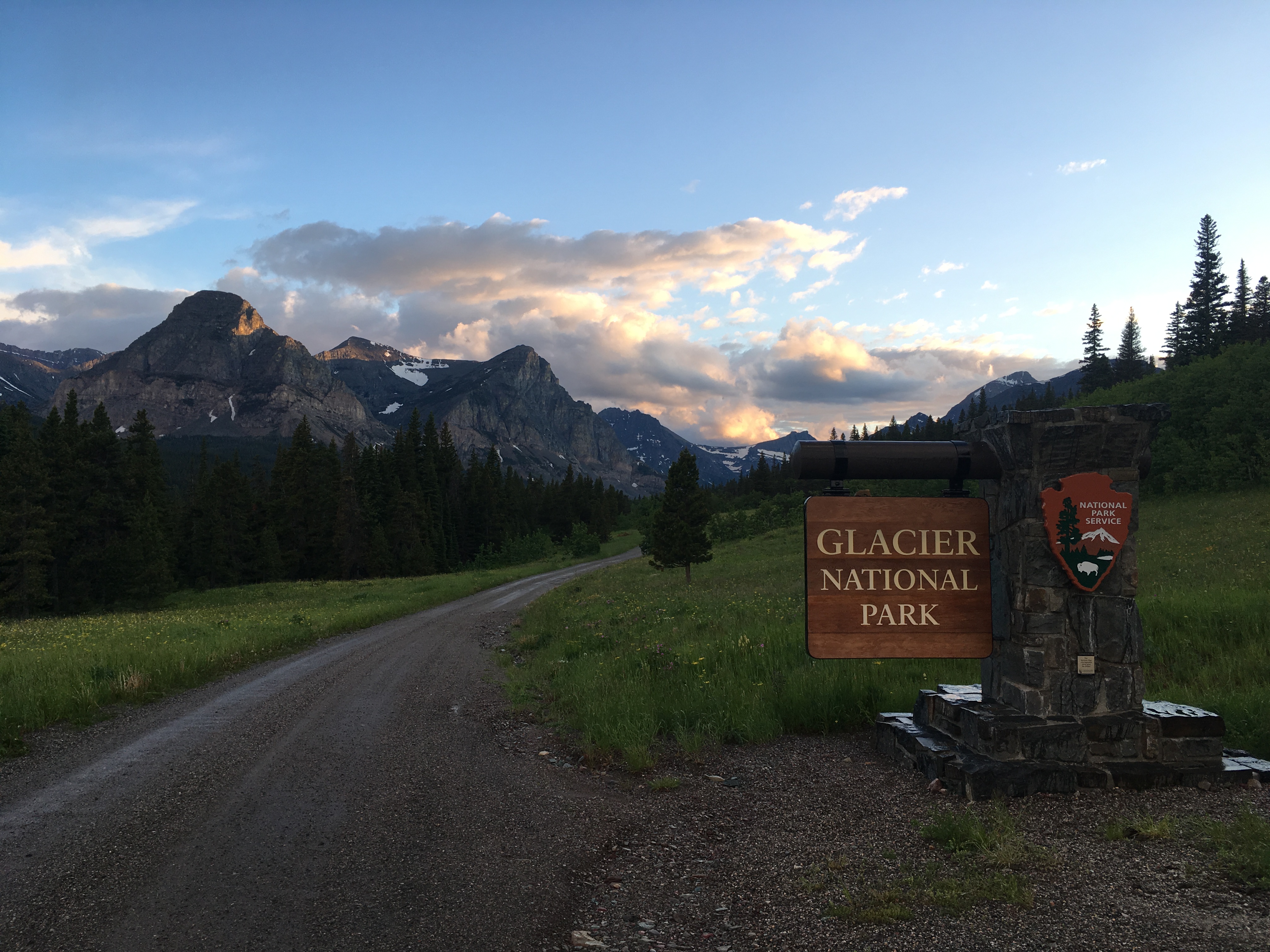
Cut Bank, a quiet and secluded area of the park, when I arrived at dusk

It’s not an adventure if eveything goes as planned. I had planned to camp for two nights at Many Glacier, but I got greedy and I am in the backcountry permit office in Many Glacier discussing backpacking options with the ranger when Many Glacier Campground fills up in the morning. So, I grab the last backcountry camping permit for Gunsight Lake for the following night, drive to Rising Sun Campground to stake out a spot for that night and then drive back to Many Glacier for a day hike.

I can’t decide whether to hike to Grinnell Glacier viewpoint or Iceberg Lake and let the parking situation dictate my decision. I get the last parking spot in front of Iceberg-Ptarmigan Trailhead, so Iceberg Lake it is! (“Ptarmigan” always makes me think of Chicken, Alaska which supposedly got its name because its early residents didn’t know how to spell “Ptarmigan.”) The trail to Iceberg Lake is perched on one side of a u-shaped glacial valley with beautiful views almost immediately of sharp fin-like glacially carved peaks. The trail was lined with Indian paintbrush and fluffy white bear grass flowers. I stop with all the other tourists to observe a mama bear and her cub playing a safe distance up a small drainage above the trail. I really enjoyed the vibrant turquoise green and brick red of the mudstone on the trail where there was water running over it. 

I stop for a snack break and water above Ptarmigan Falls, which is very much like Vernal Falls at the beginning of the JMT, but there doesn’t seem to be a good place to take a photo of the falls without falling. The second half of the trail to Iceberg Lake recalls The Great Valley from the Land Before Time, much like Yosemite Valley from Half Dome or all of Zion NP. Iceberg Lake is the tarn under the cirque at the end of the valley that forms part of the Continental Divide. The lake is beautiful when you first see it, but as I approached the shore in search of a good lunch spot, there were kids throwing rocks in the lake, rowdy folks shrieking from each other’s polar plunges and unsteady tourists trying to walk out onto the “glaciers” in the lake. A regular circus. High above the commotion, a herd of sheep impressively traversed the cirque to get to little patches of green grass, so I stayed and watched a while. 
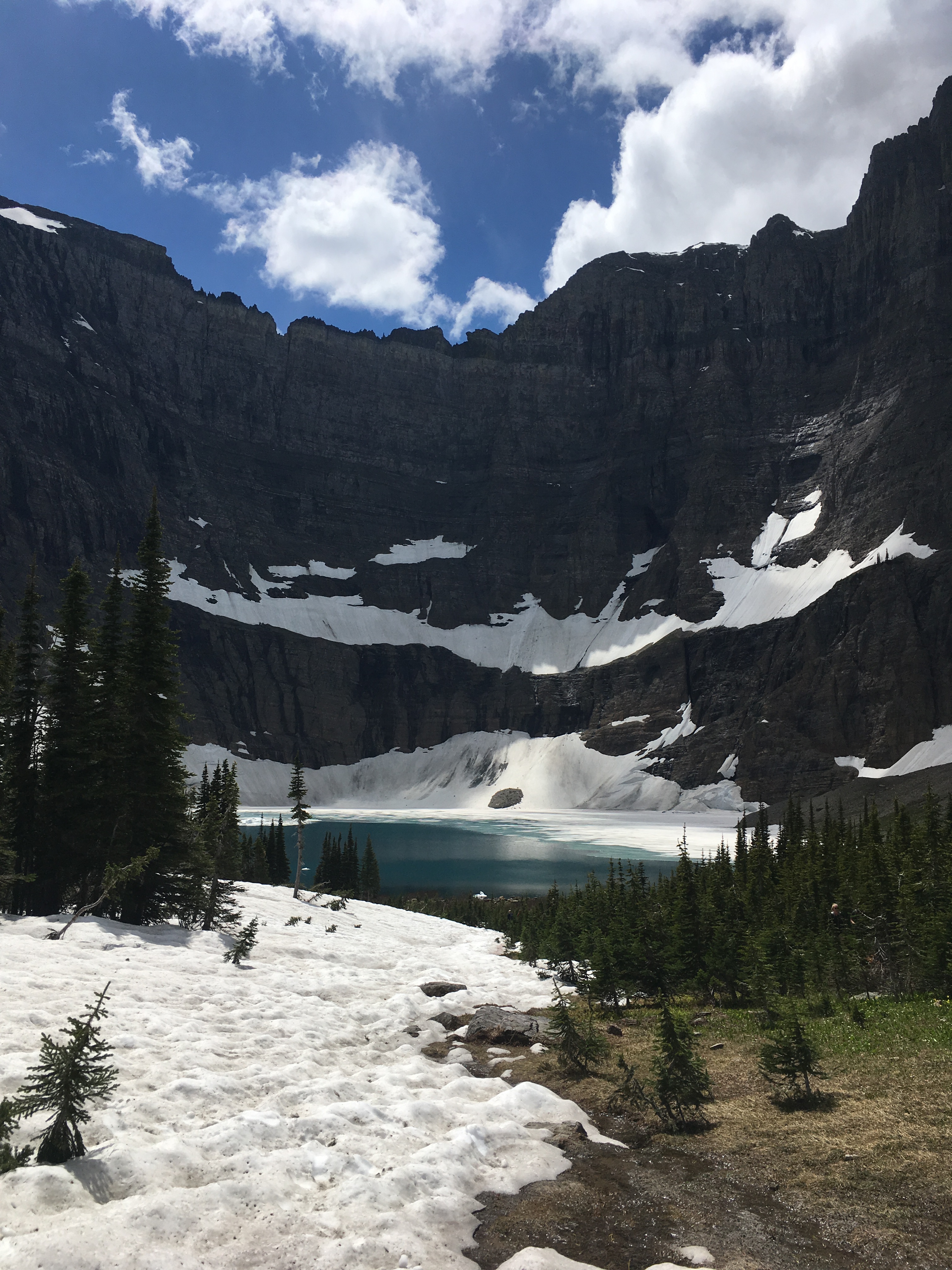
IMG-3061.JPG

Iceberg Lake

It was still early so on the way back to the trailhead, I decided to take the side trail to Ptarmigan Lake. Not a few minutes from where Ptarmigan Trail forks off, I found half a dead baby sheep on the trail, followed by some bear scat a bit further on. Unlike the trail to Iceberg Lake with its expansive views, this trail was in heavily shaded woods. I started “Hey Bear!”-ing and soon ran into two girls who told me they turned around because they were spooked. I kept going anyway, because, whatever, I’m a card carrying Montanan now and can’t be scared of no bears. 

I cross paths with an older couple coming back from Ptarmigan Lake who inform me that I’ll have it all to myself, there is no one on the trail behind them. This is excellent news in light of all the bear signs, but once they are out of earshot, I say out loud to myself, “I guess I can pee wherever I want!” Iceberg Lake trail had the problem of being too exposed and well-trafficked and there had been a line at the pit toilet. 

Following a moderate climb, the views opened up on Ptarmigan Pass. This cirque, at the end of another glacial valley that forms a Y with the one ending at Iceberg Lake, is much less dramatic and photogenic than the one at Iceberg Lake, but I can see the faint line of the trail that switchbacks up to Ptarmigan Tunnel, which is really cool. Why is there a tunnel? Why doesn’t the trail just lead over a normal pass? How did they build the tunnel? What is on the other side? Piques the imagination. It made me think of the “Tower of Babylon” short story by Ted Chiang. Ptarmigan Pass does not open until mid-July.

IMG-3080

Ptarmigan Pass in the distance

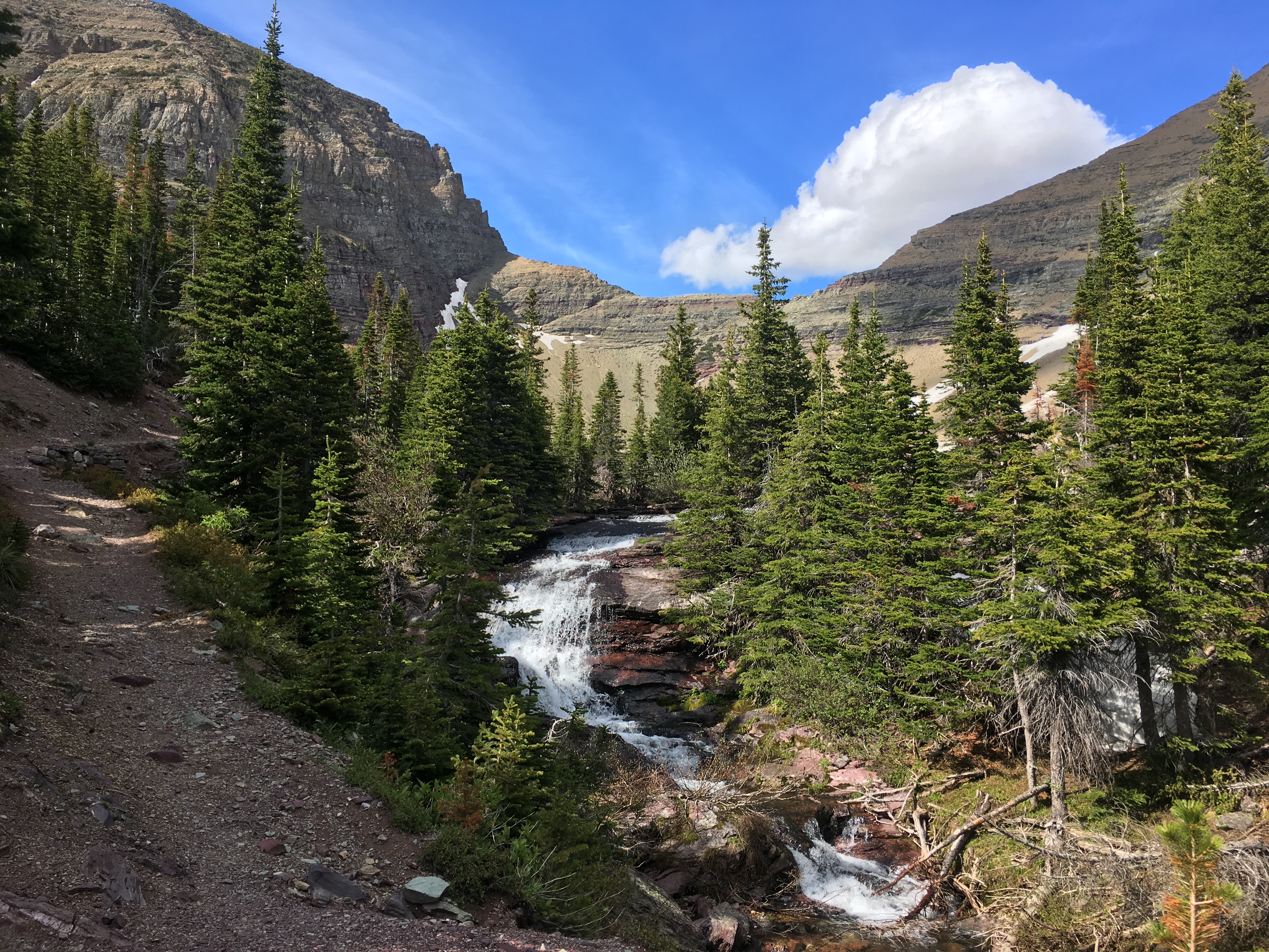
I aspired to get up early for my overnight backpacking trip, but only managed to wake up at 8am. By the time I get onto Gunsight Pass Trail (part of the CDT), it is almost 11. The trail dips off Going to the Sun Road into the lush, heavily vegetated valley floor. The trail is narrow and lined with bear grass in full bloom. When I stop for water where the trail first meets the river flowing over rocks in swirly waterfalls, a deer appears and doesn’t seem bothered by my presence. I stop for lunch where the trail follows a meandering stream at the bottom of the valley, and a moose is also lunch-ing nearby in the marsh on aquatic plants. 

IMG-3125.JPG

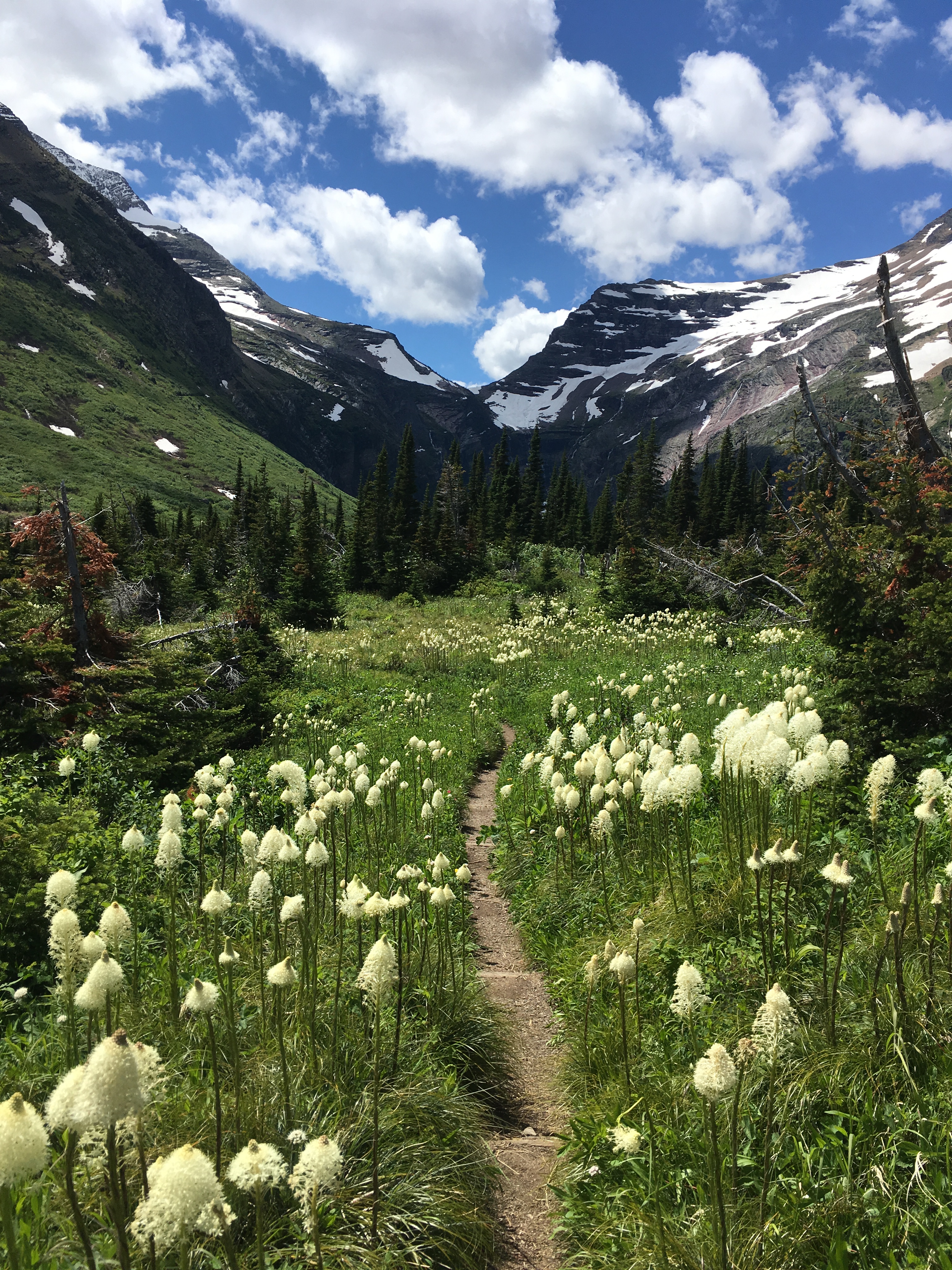
Bear grass lined trail to Gunsight Lake

I arrive at Gunsight Lake campsite around 2pm and while it looks idyllic, I seem to collect a cloud of mosquitos as I hang my food and pick a campsite. I have a headnet, but the mosquitos attack my hands as I stake out my tent. So I keep moving and after I set up my tent I head off to try to hike to Gunsight Pass and see what’s on the other side. 

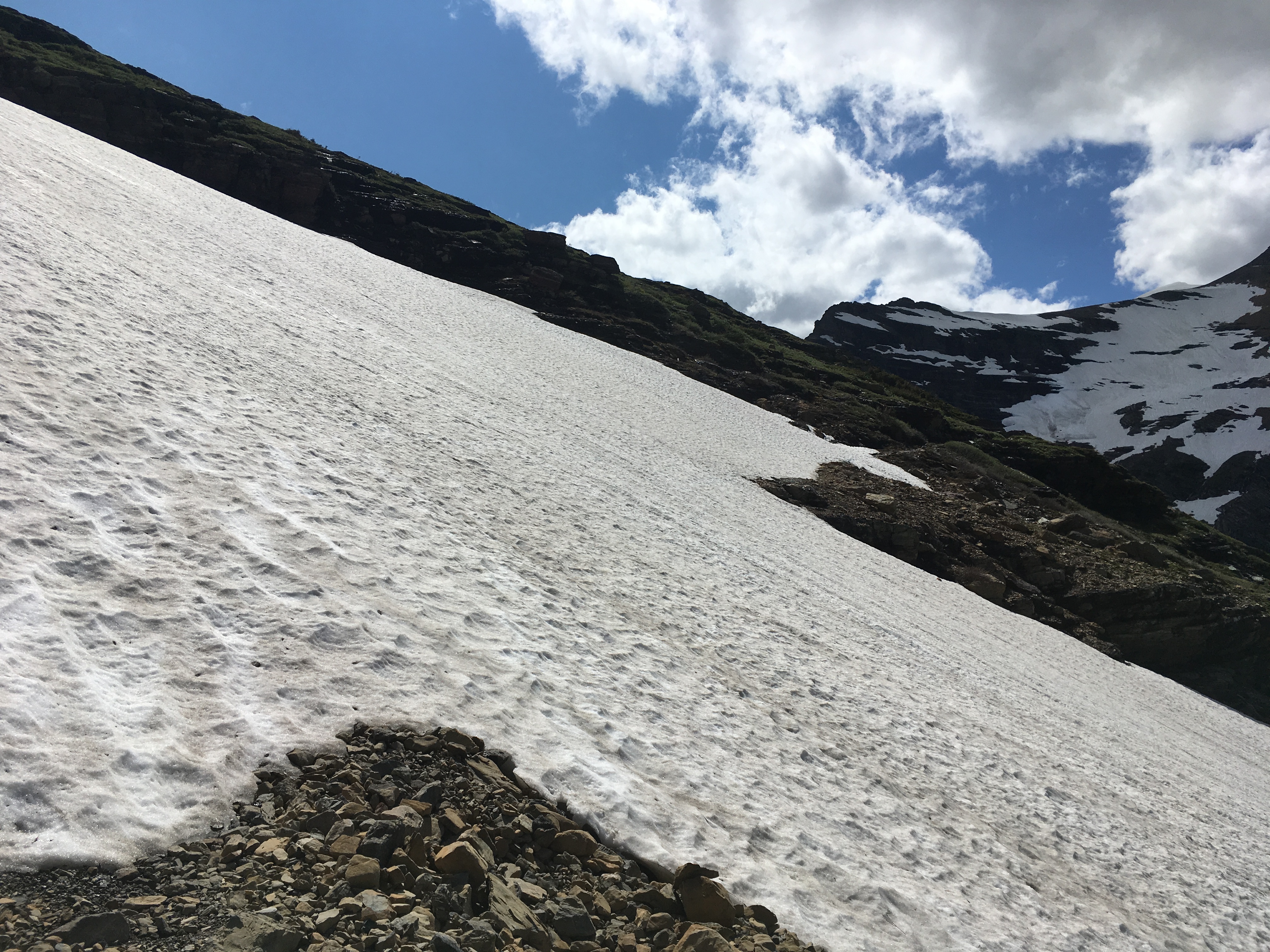
The trail climbs up over Gunsight Lake on switchbacks with great views of the splindly waterfalls on the opposite side of the valley that cascade into the lake. I climb over and around a small snowfield, then the trail cuts into the rock walls of the steep mountain side. I am thwarted from making it over the pass by a snowfield about half a mile from the pass. It’s not too wide, but would be a long drop down into Gunsight Lake. With no means of self-arrest, I decide not to risk it. I attempt to climb around the snowfield off trail, but get scared, especially after thinking about how I have to downclimb anything I climb up, turn around and head back to camp. 

IMG-3175.JPG

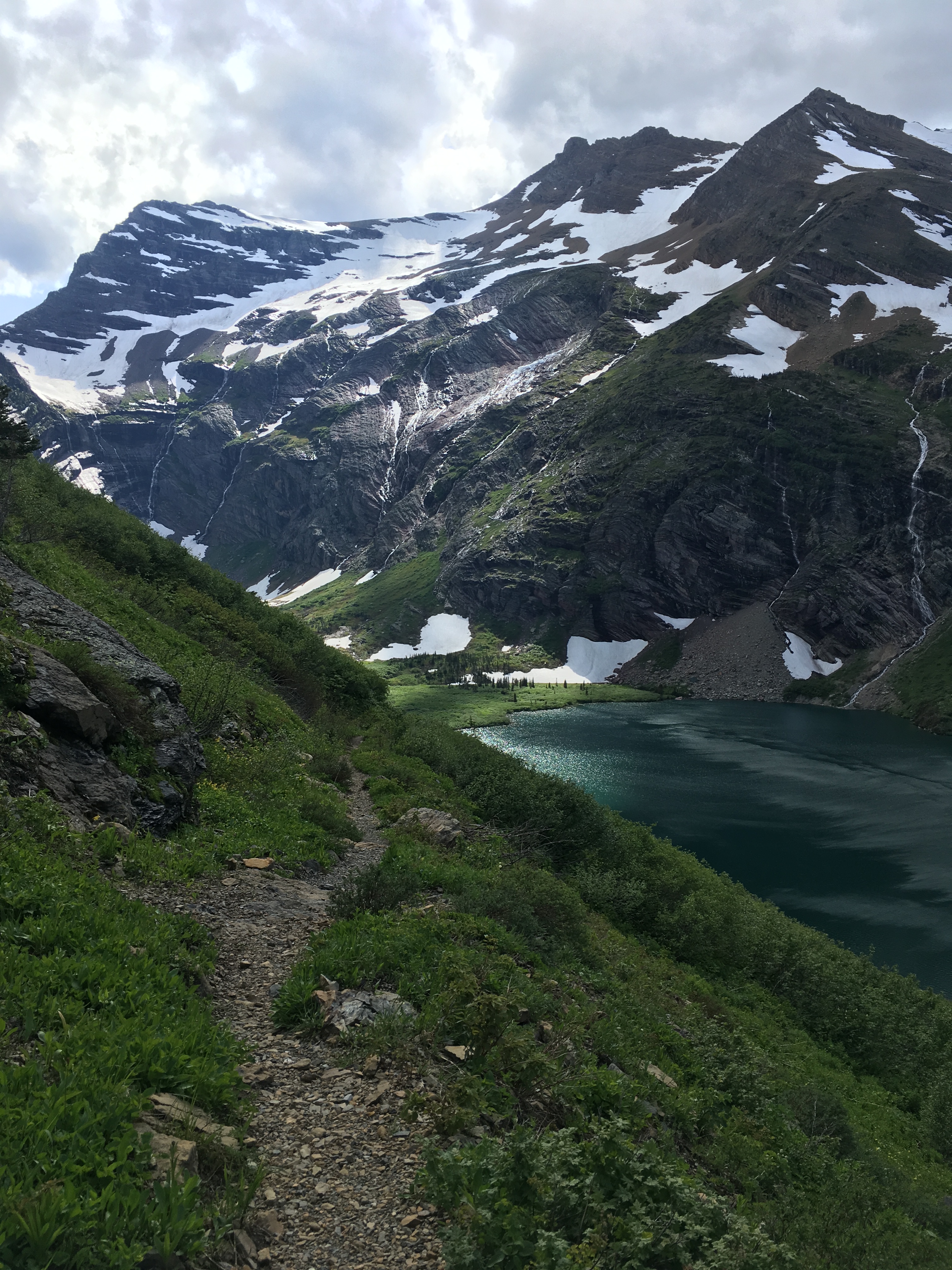
Gunsight Lake and Gunsight Pass Trail

After getting around the small snowfield I climbed over before, I see a hoary mountain goat maybe 100 feet ahead of me on the trail. It starts walking toward me so I pull out my phone and start taking photos. It starts getting really close, so I turn my phone to video and back up against the wall. I don’t want to be butted off the trail! The goat seems to check me out, probably asking for food, and determining I’m not going to feed it and am not a threat, kindly climbs up off the trail and lets me pass. I was very jealous of the ease in its climbing ability. If I was a goat, I would have made it to Gunsight Pass!

IMG-3153.JPG

Live to hike another day or YOLO?

My final day in Glacier was a straightforward hike out the way I came, a drive across the Sun road, with no stops because there was no parking anywhere, ending up at Polebridge Mercantile, where I bought and ate three pastries and hung out until they opened up the showers at 4pm. 

IMG-3203

Glacier NP definitely reminded me of Alaska, even down to Polebridge Merchantile. 

Tina’s Snow Season for POW

Hey y’all! For my 37th birthday, I’ve started a fundraiser for Protect Our Winters (POW), an environmental non-profit started by pro-snowboarder Jeremy Jones to mobilize the snow sports community to take action against climate change. Check it out: Tina’s Snow Season for POW

IMG_1172.JPG

Super stoked to ride off the Lone Peak Tram for the first time today!