September 3, 2019

I catch the 6:15 am ESTA bus from the Lone Pine MacDonald’s, which is full of backpackers repacking their packs at 6 am. I have left my car in the overflow parking of the Historic Dow Motel, which provides long-term parking to its guests. (Another place you can park while you hike for a small fee is the Museum of Western Film History.) I chat with my seatmate who has just completed the entire JMT in ten 25-30 mile days, waking up every morning at 4:30am. He says it was a sufferfest and he wishes he had gone slower so he could remember more parts of it. Most of the other folks on the bus have just finished the JMT or other hikes in the Sierra and are heading north to Reno to fly out to wherever they are from, including England and Australia. I am dropped off with one other hiker at Tioga Gas Mart at the turn off for Tioga Pass to catch the YARTS bus into Yosemite. (This is not an official ESTA stop on their website but when you make a phone reservation — which is advisable because the bus I was on was full — and tell them you are transferring to YARTS, ESTA will stop at the YARTS stop.) I feel nostalgic as I walk into the gas mart to use the restrooms. Last time I was here, I was miserable at the prospect of not being able to finish the trail.
The YARTS bus drops me off at Tuolumne Meadows just after 10 am. The Tuolumne Meadows store and campground feel like familiar ground. I go and stake out a campsite in the backpacker campground, setting up my tent and stashing my food in a bear box. Pack lightened, I hike over to the wilderness center to pick up my permit.

They give you a wag bag for Mt. Whitney when you pick up your JMT permit. I dutifully carried it to Red’s Meadow and dropped it in the hiker box with all the others. Then I picked one up from the hiker buckets at Mt. Williamson Motel in Independence. Should have just left the first one at Tuolumne Meadows.
I make a loop around Tuolumne Meadows, covering the two miles we skipped last time to hitchhike to the post office before it closed. I visit Parsons Lodge and listen in on some ranger talks, learning about habitat restoration in the delicate alpine meadows and the importance of not going off trail. I take a taste of Soda Springs and walk towards Lembert Dome. An ominous cloud builds up over the mountains to the south, and I abort the idea of climbing Lembert Dome to go hide in my tent.
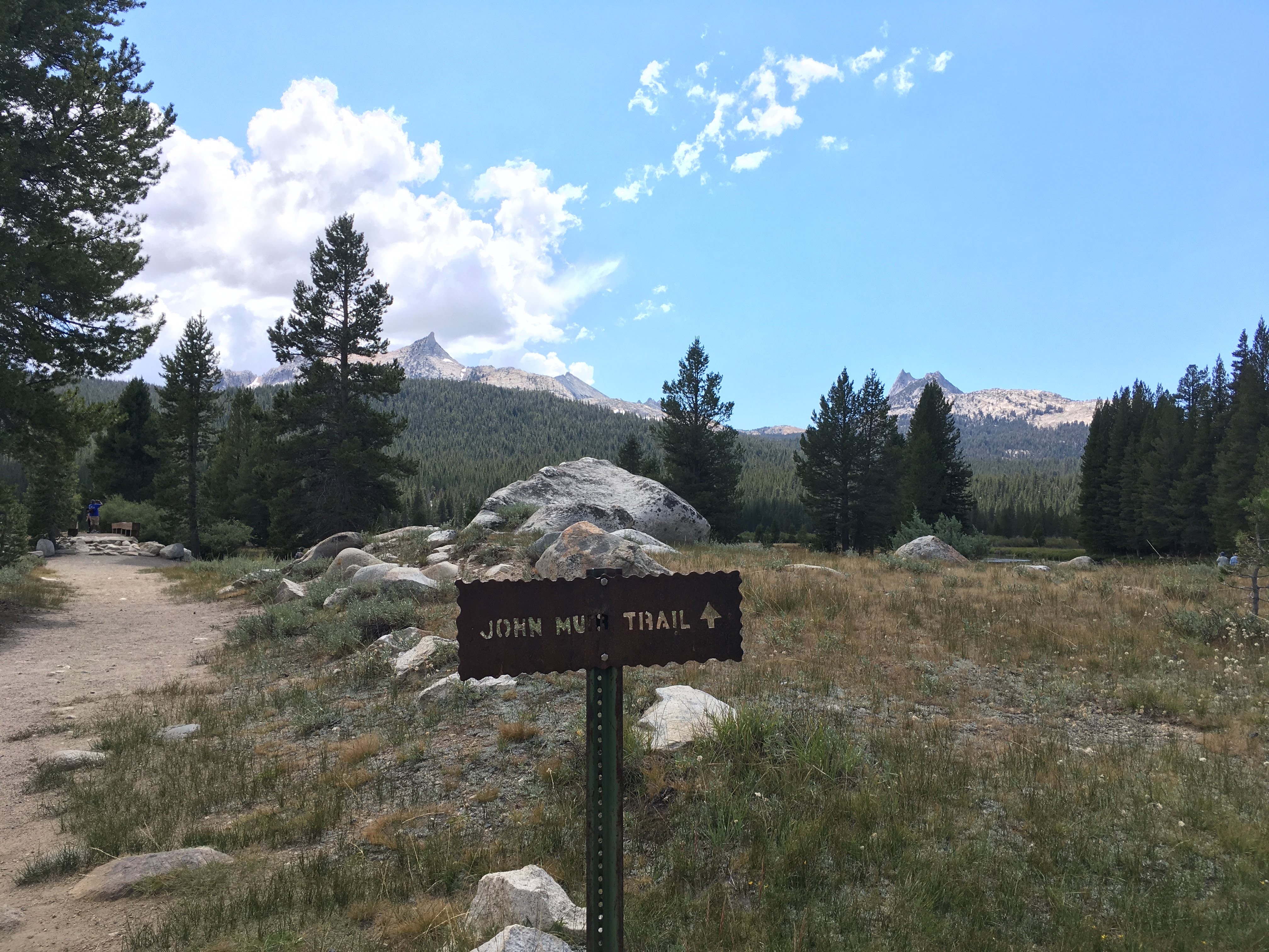
Yay! Back on the trail!
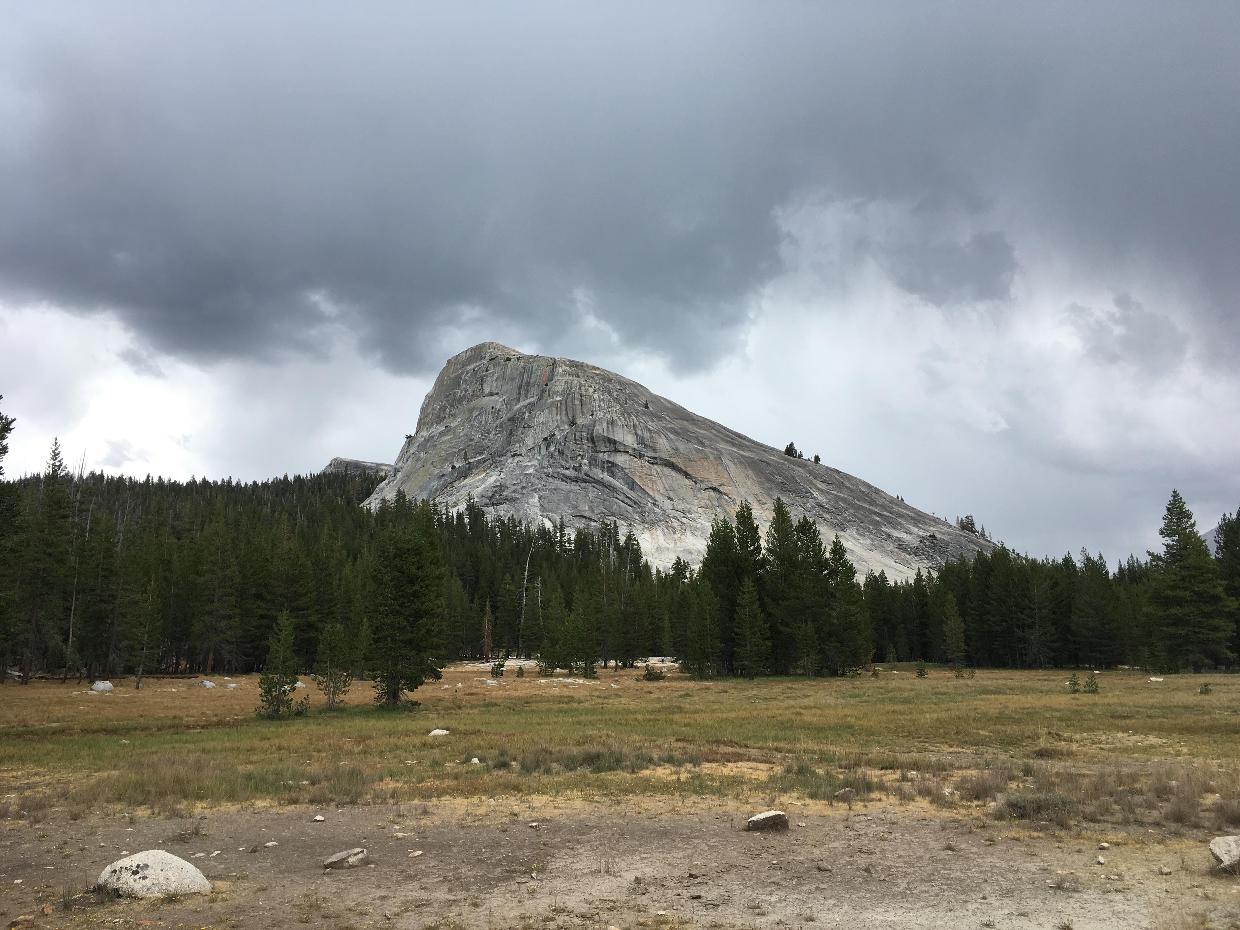
Lembert Dome
It thunders and hails but doesn’t rain much. When I set up my tent in the morning, mine is one of two or three tents set up in the backpackers’ campground. When I emerge in the afternoon, it is full, with excited hikers happily welcoming late comers to share campsites. In the evening, folks stroll around the backpackers’ campground, beer in hand, in a home and garden tour of the most popular backpacking tents on the market. A young European couple is in some kind of cuben fiber (oh, I’m sorry, DCF) spaceship that we all ooh and aw over.
There is a campfire talk in the evening about glaciers and the Q&A inevitably turns political. It’s a pleasant surprise and comforting that the NPS is still allowed to talk about climate change as a fact, though of course the ranger is mostly preaching to the choir. It ends with a super awkward rap with a refrain that she makes us sing along: “ice, ice, baby…. melting.”
*** ***
Looking back at my journal to write these posts, I noted between the entries for September 2 and September 3 simply:
Sunrise 6:23 AM
Sunset 7:16 PM
This was from the weather app on my phone so I would have an an idea of how long I had each day to hike. I knew I would lose cell reception after Lee Vining. Cell reception on the JMT is very limited. Tuolumne Meadows has Verizon, but at the time I was on an AT&T based carrier. When I left for the trail, friends said things like “Looking forward to reading your blog posts from the trail!” and I didn’t have the heart to tell them I wouldn’t actually be able to blog from the trail. I will randomly find great reception at a campsite near Trinity Lakes and post a couple photos to Instagram, and when I get to VVR, I will walk out onto the dam to text my emergency contact that I am on schedule. There is cell reception at the top of Kearsarge Pass which I will use to call and leave a message with Mt. Williamson Motel that I am on my way and that I want to take a zero and stay an additional night. That’s it. I didn’t carry any kind of satellite emergency communication device, but I met a lot of people who did. If I saw someone with a Garmin InReach hanging from their backpack shoulder strap, I would sometimes ask if they had the weather forecast. Not being connected is one of the best things about backpacking and going deep into the wilderness. I suspect it’s why I’m only able journal consistently out there.
